MyTopo
Alpowa Ridge Washington US Topo Map
Couldn't load pickup availability
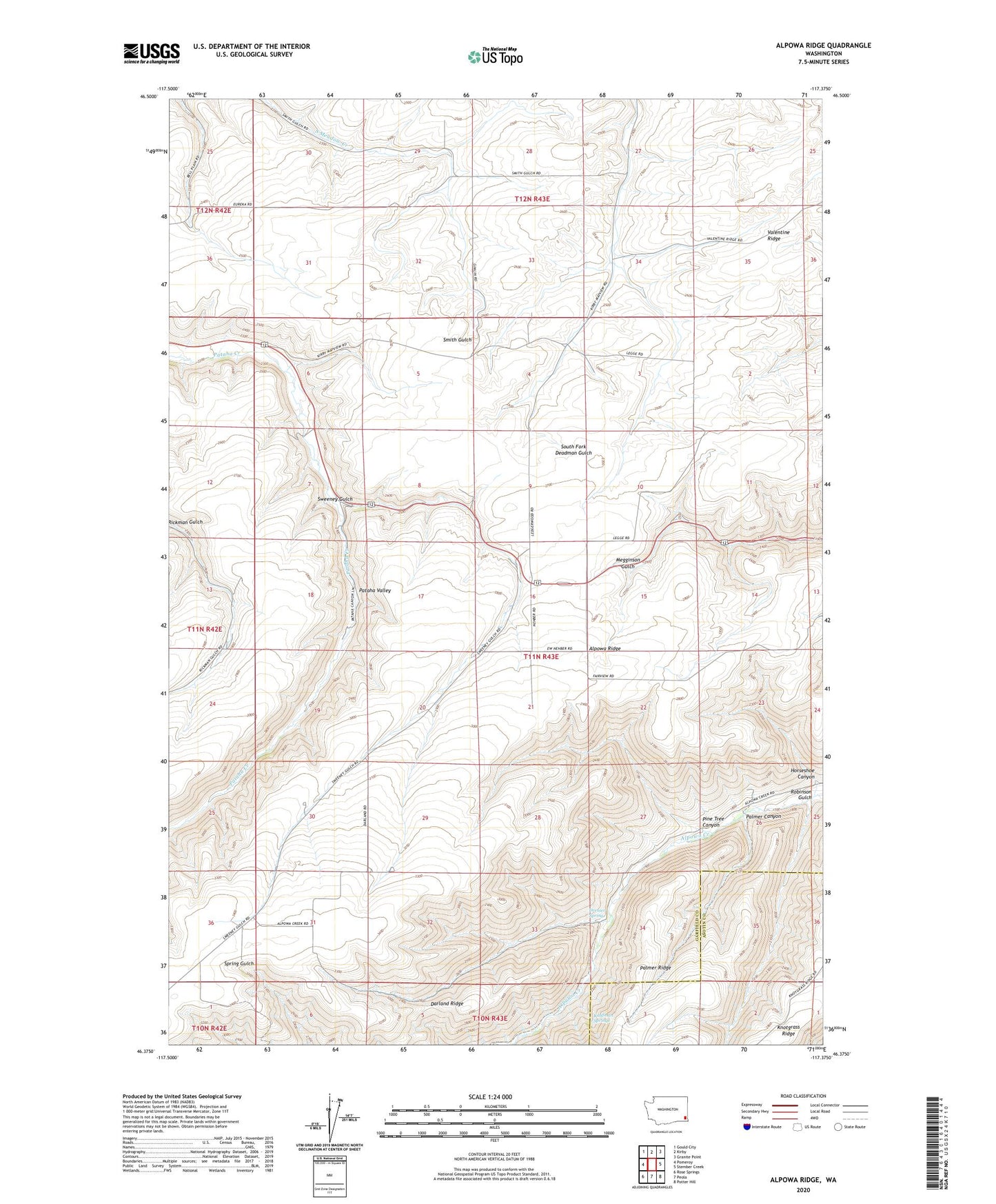
2023 topographic map quadrangle Alpowa Ridge in the state of Washington. Scale: 1:24000. Based on the newly updated USGS 7.5' US Topo map series, this map is in the following counties: Garfield, Asotin. The map contains contour data, water features, and other items you are used to seeing on USGS maps, but also has updated roads and other features. This is the next generation of topographic maps. Printed on high-quality waterproof paper with UV fade-resistant inks.
Quads adjacent to this one:
West: Pomeroy
Northwest: Gould City
North: Kirby
Northeast: Granite Point
East: Stember Creek
Southeast: Potter Hill
South: Peola
Southwest: Rose Springs
This map covers the same area as the classic USGS quad with code o46117d4.
Contains the following named places: Alpowa Ridge, Darland Ridge, Dresser Spring, Horseshoe Canyon, Kaufman Springs, Mentor, Palmer Canyon, Palmer Ridge, Philomathian School, Pine Tree Canyon, Raffertys Ranch, Robinson Gulch, Sweeney Gulch