MyTopo
Prince Creek Washington US Topo Map
Couldn't load pickup availability
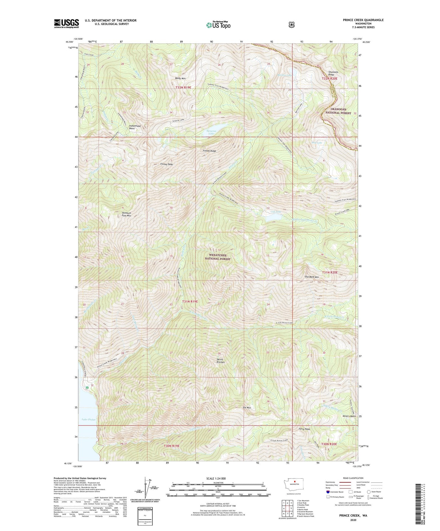
2020 topographic map quadrangle Prince Creek in the state of Washington. Scale: 1:24000. Based on the newly updated USGS 7.5' US Topo map series, this map is in the following counties: Chelan, Okanogan. The map contains contour data, water features, and other items you are used to seeing on USGS maps, but also has updated roads and other features. This is the next generation of topographic maps. Printed on high-quality waterproof paper with UV fade-resistant inks.
Quads adjacent to this one:
West: Lucerne
Northwest: Sun Mountain
North: Oval Peak
Northeast: Hoodoo Peak
East: Martin Peak
Southeast: South Navarre Peak
South: Big Goat Mountain
Southwest: Pyramid Mountain
Contains the following named places: Baldy Creek, Baldy Mountain, Bernice Lake, Canoe Creek, Cub Lake, Cub Lake Campsite, Devils Kitchen, Dry Lake, East Fork Prince Creek, Ferry Peak, Finney Peak, Finney Ridge, Goat Pass Canyon, Goat Spring Creek, Indian Creek, Indianhead Basin, Middle Fork Prince Creek, Miners Basin, Old Maid Mountain, Prince Creek, Prince Creek Campground, Prince Creek Guard Station, Skookum Puss Mountain, Surprise Lake, Surprise Lake Campsite, Vie Mountain