MyTopo
Oval Peak Washington US Topo Map
Couldn't load pickup availability
Also explore the Oval Peak Forest Service Topo of this same quad for updated USFS data
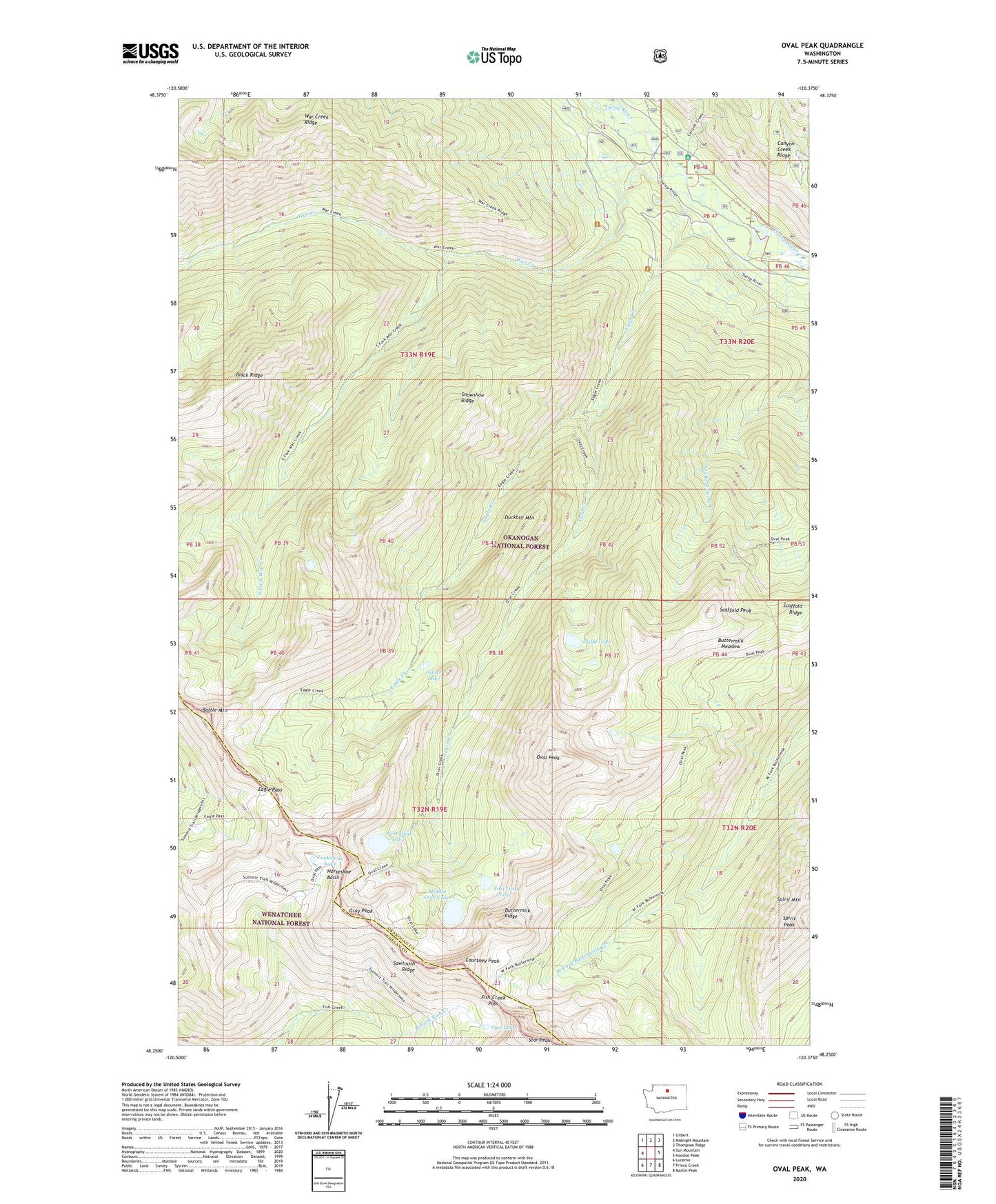
2023 topographic map quadrangle Oval Peak in the state of Washington. Scale: 1:24000. Based on the newly updated USGS 7.5' US Topo map series, this map is in the following counties: Okanogan, Chelan. The map contains contour data, water features, and other items you are used to seeing on USGS maps, but also has updated roads and other features. This is the next generation of topographic maps. Printed on high-quality waterproof paper with UV fade-resistant inks.
Quads adjacent to this one:
West: Sun Mountain
Northwest: Gilbert
North: Midnight Mountain
Northeast: Thompson Ridge
East: Hoodoo Peak
Southeast: Martin Peak
South: Prince Creek
Southwest: Lucerne
This map covers the same area as the classic USGS quad with code o48120c4.
Contains the following named places: Battle Mountain, Buttermilk Meadow, Buttermilk Ridge, Courtney Peak, Duckbill Mountain, Duffy Lake, Eagle Creek, Eagle Pass, East Oval Lake, Fish Creek Pass, Gray Peak, Horseshoe Basin, Lake Chelan-Sawtooth Wilderness, Middle Oval Lake, Oval Creek, Oval Lakes, Oval Peak, Sawtooth Ridge, Scaffold Peak, Scaffold Ridge, Silver Lake, Snowshoe Ridge, South Fork War Creek, Spirit Mountain, Spirit Peak, Star Lake, Star Peak, Tuckaway Lake, War Creek, War Creek Campground, West Oval Lake