MyTopo
Sun Mountain Washington US Topo Map
Couldn't load pickup availability
Also explore the Sun Mountain Forest Service Topo of this same quad for updated USFS data
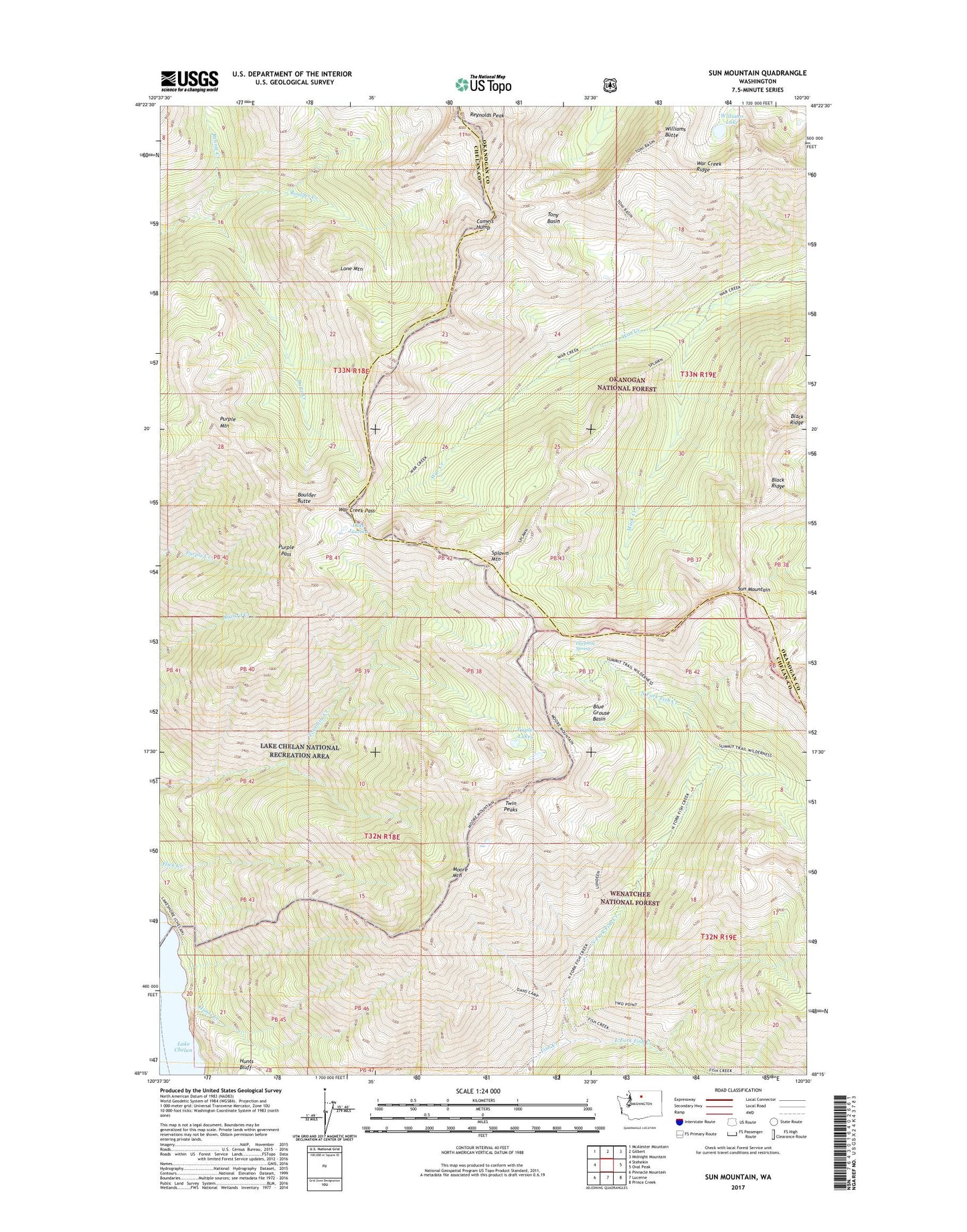
2023 topographic map quadrangle Sun Mountain in the state of Washington. Scale: 1:24000. Based on the newly updated USGS 7.5' US Topo map series, this map is in the following counties: Chelan, Okanogan. The map contains contour data, water features, and other items you are used to seeing on USGS maps, but also has updated roads and other features. This is the next generation of topographic maps. Printed on high-quality waterproof paper with UV fade-resistant inks.
Quads adjacent to this one:
West: Stehekin
Northwest: McAlester Mountain
North: Gilbert
Northeast: Midnight Mountain
East: Oval Peak
Southeast: Prince Creek
South: Lucerne
Southwest: Pinnacle Mountain
This map covers the same area as the classic USGS quad with code o48120c5.
Contains the following named places: Black Ridge, Blue Grouse Basin, Boulder Butte, Butte Creek, Camels Hump, Deephole Spring, East Fork Fish Creek, Flick Creek Campground, Hunts Creek, Lake Juanita, Lone Mountain, Mack Creek, Moore Mountain, North Fork Fish Creek, Purple Mountain, Purple Pass, Rennie Creek, Splawn Mountain, Sun Mountain, Tony Basin, Triplet Lakes, Twin Peaks, War Creek Pass, War Creek Ridge, Williams Butte, Williams Lake, ZIP Code: 98852