MyTopo
Randle Washington US Topo Map
Couldn't load pickup availability
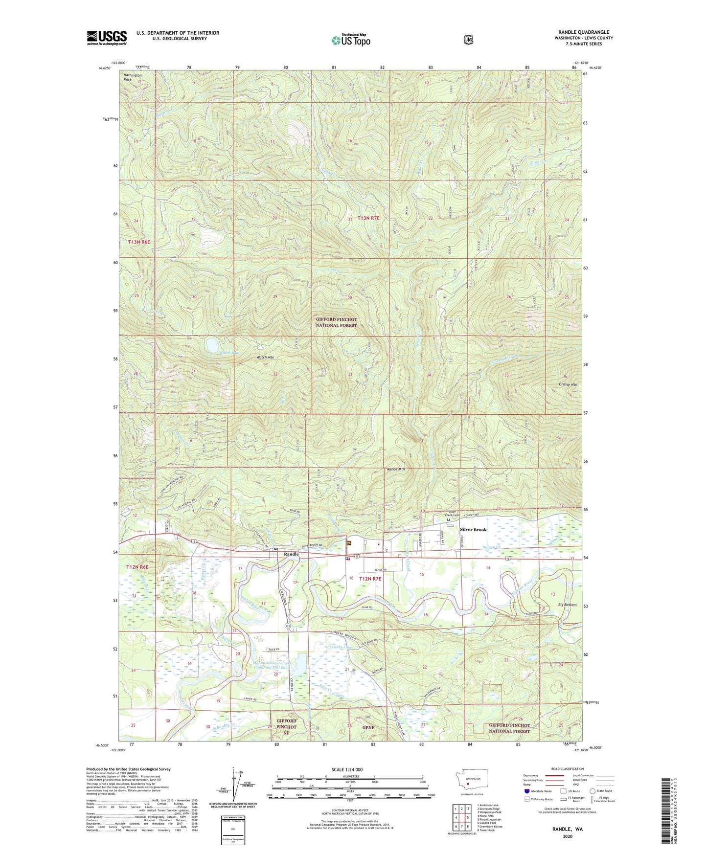
2020 topographic map quadrangle Randle in the state of Washington. Scale: 1:24000. Based on the newly updated USGS 7.5' US Topo map series, this map is in the following counties: Lewis. The map contains contour data, water features, and other items you are used to seeing on USGS maps, but also has updated roads and other features. This is the next generation of topographic maps. Printed on high-quality waterproof paper with UV fade-resistant inks.
Quads adjacent to this one:
West: Kiona Peak
Northwest: Anderson Lake
North: Sawtooth Ridge
Northeast: Wahpenayo Peak
East: Purcell Mountain
Southeast: Tower Rock
South: Greenhorn Buttes
Southwest: Cowlitz Falls
Contains the following named places: East Fork Silver Creek, Gibbs Lake, Hampton Creek, Harrington Rock, Kehoe Mountain, Kiona Creek, Lake Creek, Lewis County Fire District 14 Randle Fire and Emergency Medical Services Station 1, Lewis County Sheriff's Office Randle, Lynx Creek, Martin Creek, Miller Creek, Mount Adams Veneer Company Mill Pond, Mount Adams Veneer Company Mill Pond Dam, Oliver Creek, Peters Creek, Randle, Randle Post Office, Schooley Creek, Sethe Creek, Siler, Siler Creek, Silver Brook, Silver Creek, Silver Creek Campground, Silver Creek Cemetery, Spears Creek, Stud Log Pond Dam, Surrey Creek, Vance, Watch Lake, Watch Mountain, Watch Mountain Lookout Tower, White Pass Elementary School, White Pass Junior - Senior High School, Willie Creek, ZIP Code: 98377