MyTopo
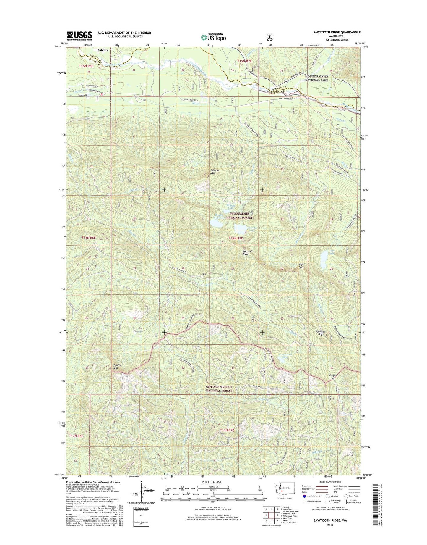
Sawtooth Ridge Washington US Topo Map
Couldn't load pickup availability
Also explore the Sawtooth Ridge Forest Service Topo of this same quad for updated USFS data
2023 topographic map quadrangle Sawtooth Ridge in the state of Washington. Scale: 1:24000. Based on the newly updated USGS 7.5' US Topo map series, this map is in the following counties: Lewis, Pierce. The map contains contour data, water features, and other items you are used to seeing on USGS maps, but also has updated roads and other features. This is the next generation of topographic maps. Printed on high-quality waterproof paper with UV fade-resistant inks.
Quads adjacent to this one:
West: Anderson Lake
Northwest: Ashford
North: Mount Wow
Northeast: Mount Rainier West
East: Wahpenayo Peak
Southeast: Purcell Mountain
South: Randle
Southwest: Kiona Peak
This map covers the same area as the classic USGS quad with code o46121f8.
Contains the following named places: Berry Creek, Bertha May Lake, Big Creek Campground, Big Creek Trail, Cave Creek, Cora Lake, Cougar Gap, Granite Lake, Greenwood Lake, Griffin Mountain, High Rock, High Rock Campground, Lewis County Fire Protection District 17, Mesatchee Creek, Nisqually Entrance Ranger Station, Nisqually Guard Station, Osborne Mountain, Osborne Mountain Trail, Pothole Lake, Sawtooth Ridge, Sunshine Point, Sunshine Point Campground, Tahoma Creek, Teeley Creek, Tenas Creek, Towhead Gap