MyTopo
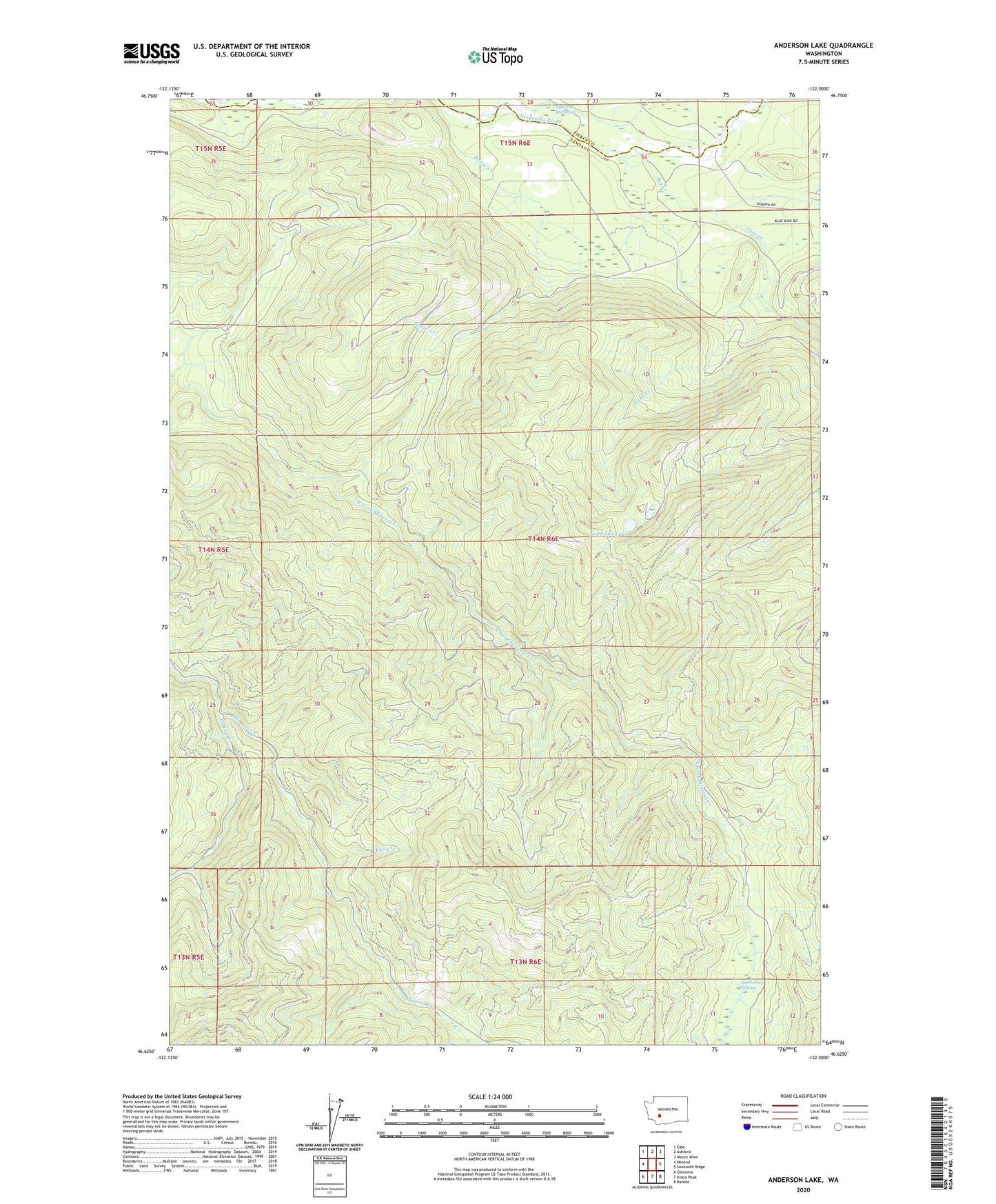
Anderson Lake Washington US Topo Map
Couldn't load pickup availability
Also explore the Anderson Lake Forest Service Topo of this same quad for updated USFS data
2023 topographic map quadrangle Anderson Lake in the state of Washington. Scale: 1:24000. Based on the newly updated USGS 7.5' US Topo map series, this map is in the following counties: Lewis, Pierce. The map contains contour data, water features, and other items you are used to seeing on USGS maps, but also has updated roads and other features. This is the next generation of topographic maps. Printed on high-quality waterproof paper with UV fade-resistant inks.
Quads adjacent to this one:
West: Mineral
Northwest: Elbe
North: Ashford
Northeast: Mount Wow
East: Sawtooth Ridge
Southeast: Randle
South: Kiona Peak
Southwest: Glenoma
This map covers the same area as the classic USGS quad with code o46122f1.
Contains the following named places: Anderson Lake, Big Creek, Catt Creek, Gallup Creek, Lake Creek, National Lookout, National Mill Pond, National Mill Pond Dam, National Mountain Lookout, Reese Creek, Ruby Creek, ZIP Code: 98355