MyTopo
Reardan West Washington US Topo Map
Couldn't load pickup availability
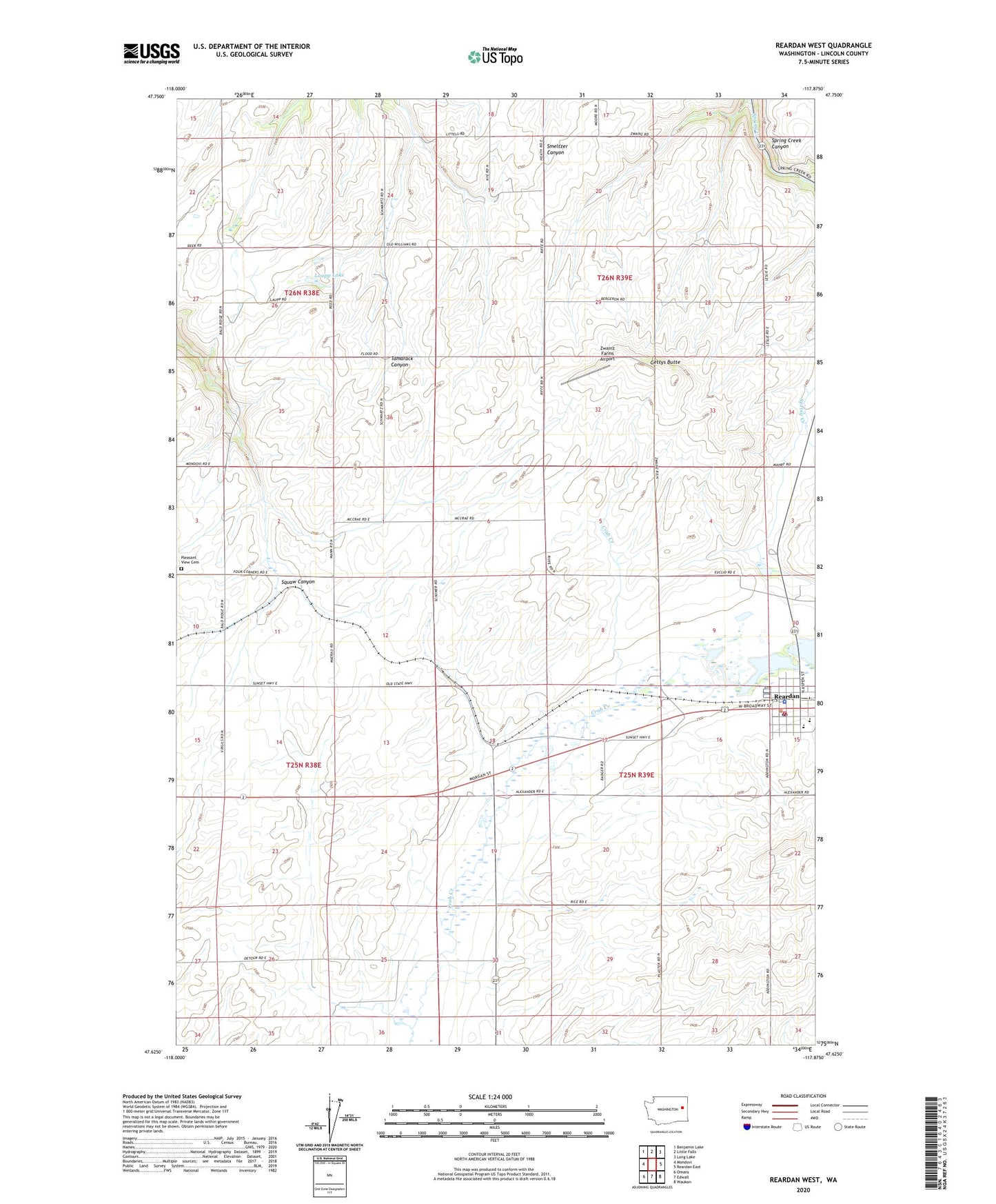
2023 topographic map quadrangle Reardan West in the state of Washington. Scale: 1:24000. Based on the newly updated USGS 7.5' US Topo map series, this map is in the following counties: Lincoln. The map contains contour data, water features, and other items you are used to seeing on USGS maps, but also has updated roads and other features. This is the next generation of topographic maps. Printed on high-quality waterproof paper with UV fade-resistant inks.
Quads adjacent to this one:
West: Mondovi
Northwest: Benjamin Lake
North: Little Falls
Northeast: Long Lake
East: Reardan East
Southeast: Waukon
South: Edwall
Southwest: Omans
This map covers the same area as the classic USGS quad with code o47117f8.
Contains the following named places: Gettys Butte, Laupp Lake, Lincoln County Fire District 4 Reardon Station, Reardan, Reardan Elementary School, Reardan Middle / High School, Reardan Police Department, Reardon Post Office, Town of Reardan, Zwainz Farms Airport