MyTopo
Long Lake Washington US Topo Map
Couldn't load pickup availability
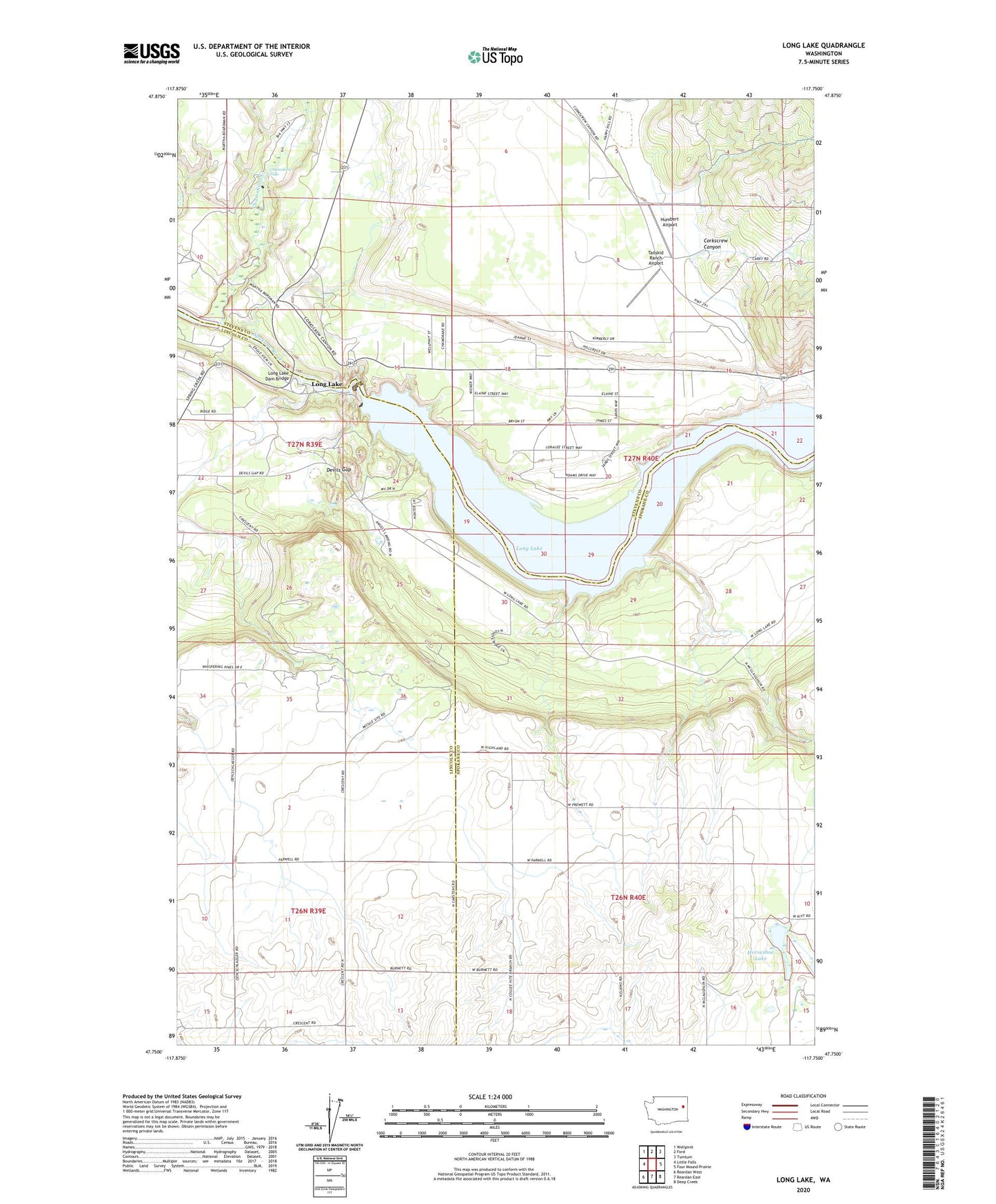
2023 topographic map quadrangle Long Lake in the state of Washington. Scale: 1:24000. Based on the newly updated USGS 7.5' US Topo map series, this map is in the following counties: Stevens, Spokane, Lincoln. The map contains contour data, water features, and other items you are used to seeing on USGS maps, but also has updated roads and other features. This is the next generation of topographic maps. Printed on high-quality waterproof paper with UV fade-resistant inks.
Quads adjacent to this one:
West: Little Falls
Northwest: Wellpinit
North: Ford
Northeast: Tumtum
East: Four Mound Prairie
Southeast: Deep Creek
South: Reardan East
Southwest: Reardan West
This map covers the same area as the classic USGS quad with code o47117g7.
Contains the following named places: Chamokane Creek, Chamokane Falls, Corkscrew Canyon, Devils Gap, Eagle's Roost Airport, Horseshoe Lake, Humbert Airport, Long Lake, Long Lake Dam, Long Lake Dam Bridge, Robel Orchards, Tailskid Ranch Airport, Wolleber Lake, Wollweber Dam, ZIP Code: 99034