MyTopo
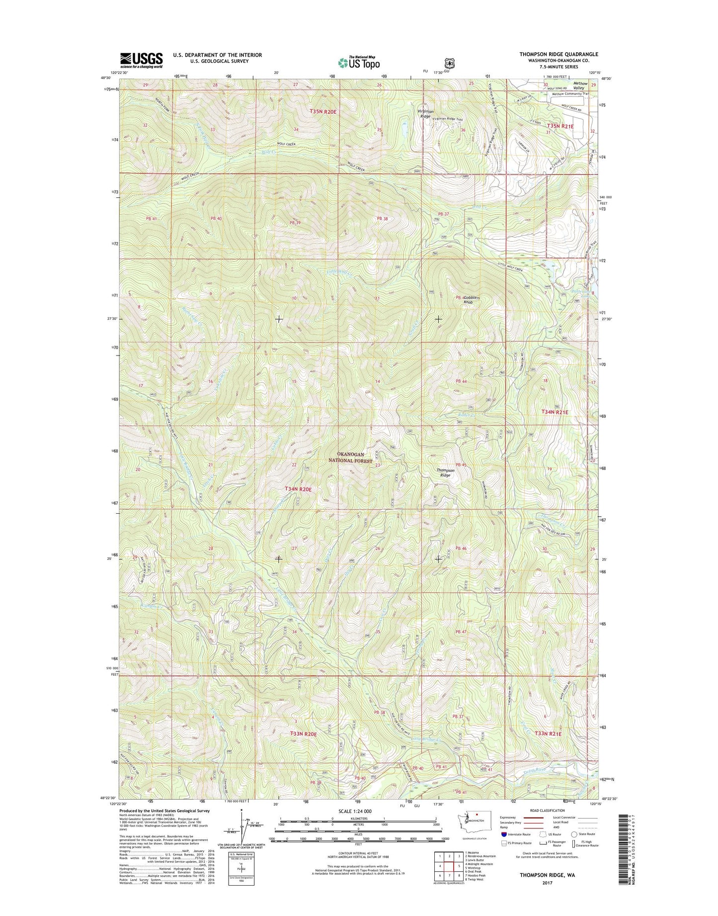
Thompson Ridge Washington US Topo Map
Couldn't load pickup availability
Also explore the Thompson Ridge Forest Service Topo of this same quad for updated USFS data
2023 topographic map quadrangle Thompson Ridge in the state of Washington. Scale: 1:24000. Based on the newly updated USGS 7.5' US Topo map series, this map is in the following counties: Okanogan. The map contains contour data, water features, and other items you are used to seeing on USGS maps, but also has updated roads and other features. This is the next generation of topographic maps. Printed on high-quality waterproof paper with UV fade-resistant inks.
Quads adjacent to this one:
West: Midnight Mountain
Northwest: Mazama
North: Rendevous Mountain
Northeast: Lewis Butte
East: Winthrop
Southeast: Twisp West
South: Hoodoo Peak
Southwest: Oval Peak
This map covers the same area as the classic USGS quad with code o48120d3.
Contains the following named places: Burnt Saw Creek, Cabin Creek, Coal Creek, Cow Creek, Deer Creek, Dry Creek, Gobblers Knob, Graff Creek, Little Bridge Creek, Little Wolf Creek, Myer Creek, Newby Creek, North Fork Wolf Creek, Patterson Lake Dam, Sheep Creek, Spring Creek, Thompson Ridge, Valentine Creek, Vetch Creek, Wolf Creek Research Natural Area