MyTopo
Slate Peak Washington US Topo Map
Couldn't load pickup availability
Also explore the Slate Peak Forest Service Topo of this same quad for updated USFS data
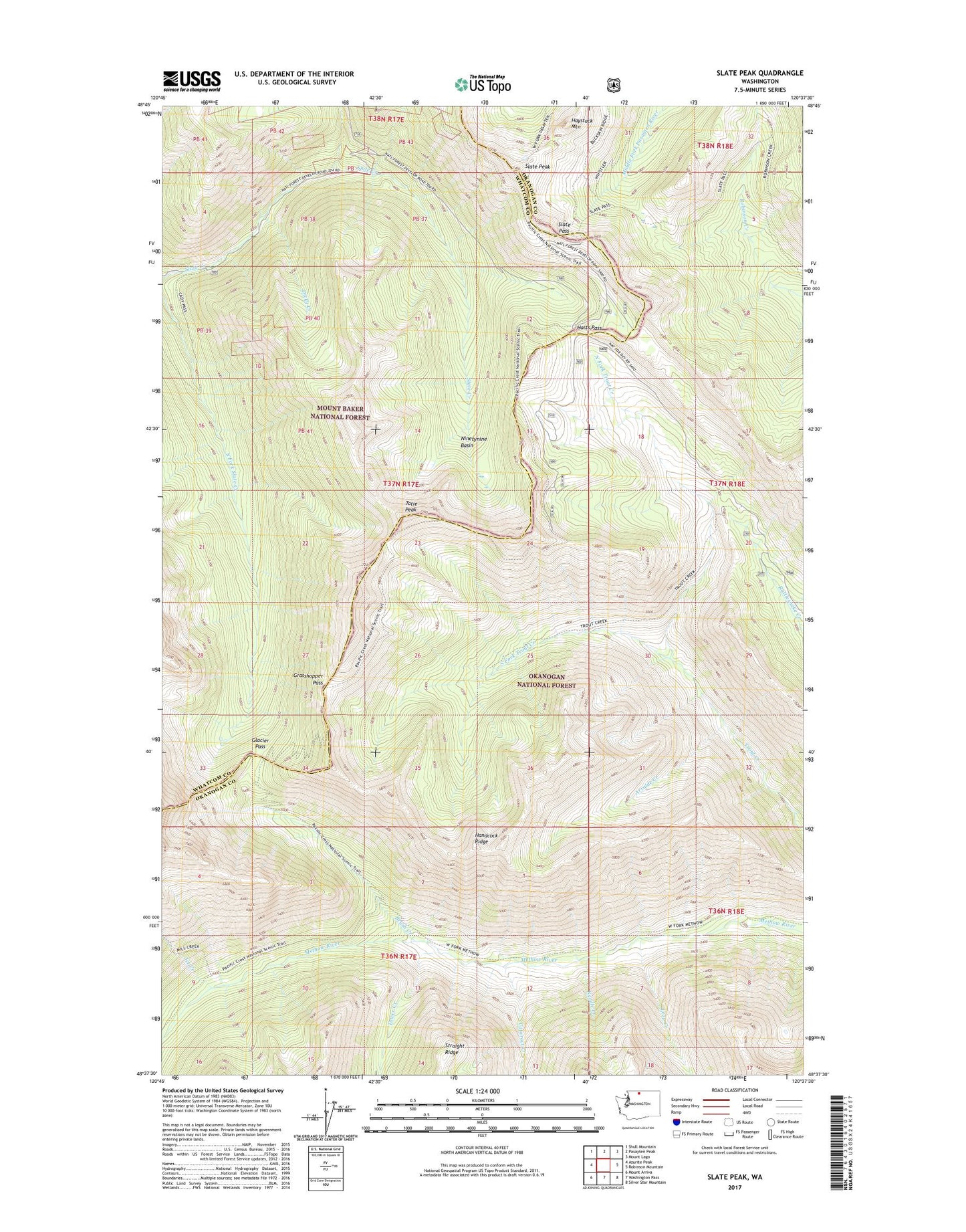
2023 topographic map quadrangle Slate Peak in the state of Washington. Scale: 1:24000. Based on the newly updated USGS 7.5' US Topo map series, this map is in the following counties: Okanogan, Whatcom, Skagit. The map contains contour data, water features, and other items you are used to seeing on USGS maps, but also has updated roads and other features. This is the next generation of topographic maps. Printed on high-quality waterproof paper with UV fade-resistant inks.
Quads adjacent to this one:
West: Azurite Peak
Northwest: Shull Mountain
North: Pasayten Peak
Northeast: Mount Lago
East: Robinson Mountain
Southeast: Silver Star Mountain
South: Washington Pass
Southwest: Mount Arriva
This map covers the same area as the classic USGS quad with code o48120f6.
Contains the following named places: Arralde Creek, Brown Bear Mine, Brush Creek, Cataract Creek, Deer Park Camp, Dicky Creek, Glacier Pass, Goat Mine, Grasshopper Pass, Handcock Ridge, Harts Pass, Harts Pass Trailhead, Haystack Mountain, Horse Heaven, Horse Heaven Camp, Illinois Mine, Jet Creek, Layout Camp, Leap Creek, Meadows Campground, Needle Creek, Ninetynine Basin, North Fork Trout Creek, Rattlesnake Creek, Slate Pass, Slate Peak, South Fork Trout Creek, Tatie Peak, Tower Creek, West Fork Methow Trail, Whistler Mine