MyTopo
Rockport Washington US Topo Map
Couldn't load pickup availability
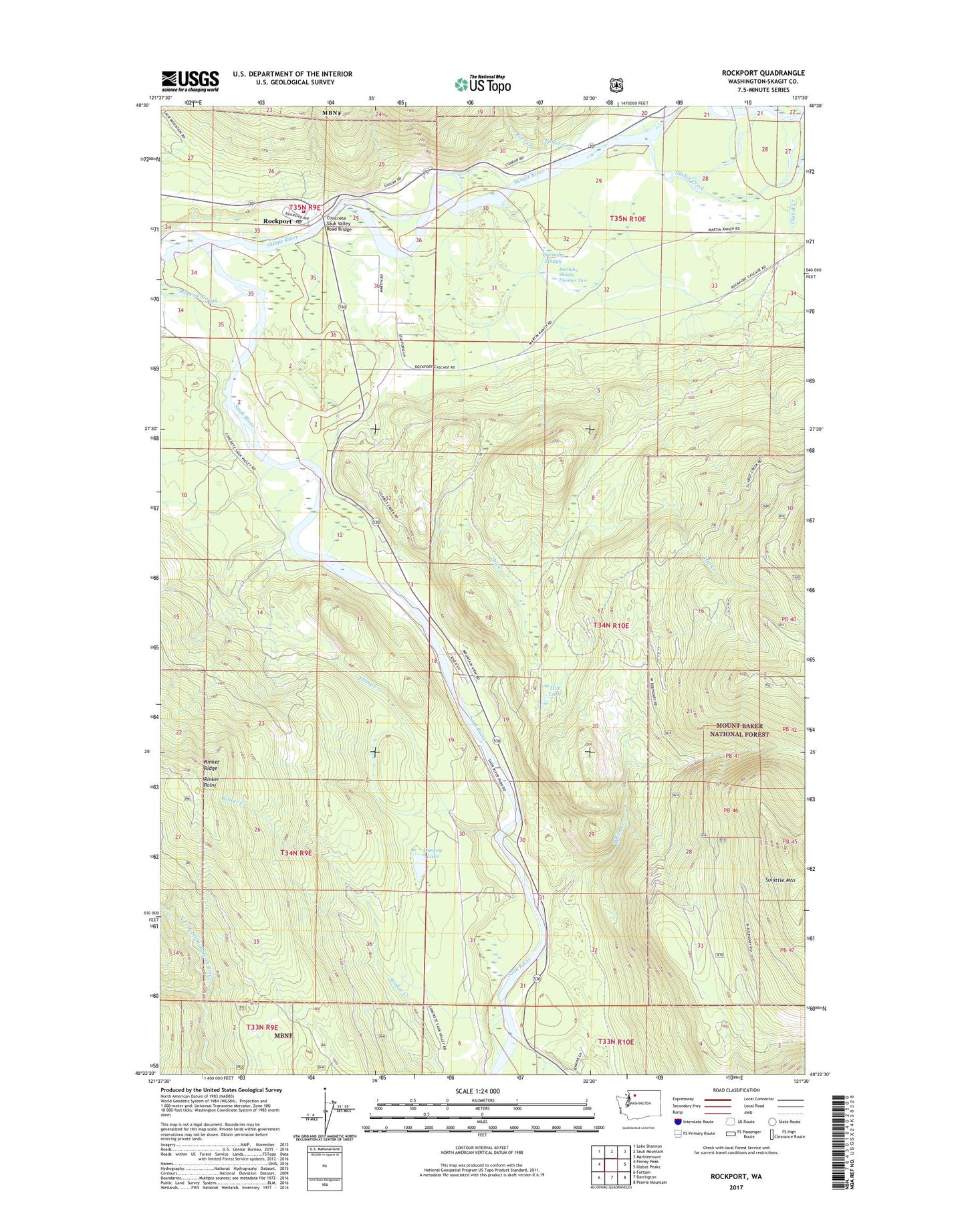
2020 topographic map quadrangle Rockport in the state of Washington. Scale: 1:24000. Based on the newly updated USGS 7.5' US Topo map series, this map is in the following counties: Skagit. The map contains contour data, water features, and other items you are used to seeing on USGS maps, but also has updated roads and other features. This is the next generation of topographic maps. Printed on high-quality waterproof paper with UV fade-resistant inks.
Quads adjacent to this one:
West: Finney Peak
Northwest: Lake Shannon
North: Sauk Mountain
Northeast: Marblemount
East: Illabot Peaks
Southeast: Prairie Mountain
South: Darrington
Southwest: Fortson
Contains the following named places: Barnaby Slough, Barnaby Slough Number Two, Barnaby Slough Number Two Dam, Barr Creek, Caskey Lake, Concrete Sauk Valley Road Bridge, Flume Creek, Hidden Valley Ranch, Hilt Creek, Hilt Lake, Howard Miller Steelhead Recreational Vehicle Park, Illabot Creek, Middle Branch North Fork Stillaguamish River, Rinker Point, Rockport, Rockport Census Designated Place, Rockport Post Office, Rockport State Park, Sauk River, Skagit County Fire District 19 Rockport Fire Department, Skagit Wild and Scenic River, Suiattle Mountain, Sutter Creek, White Creek