MyTopo
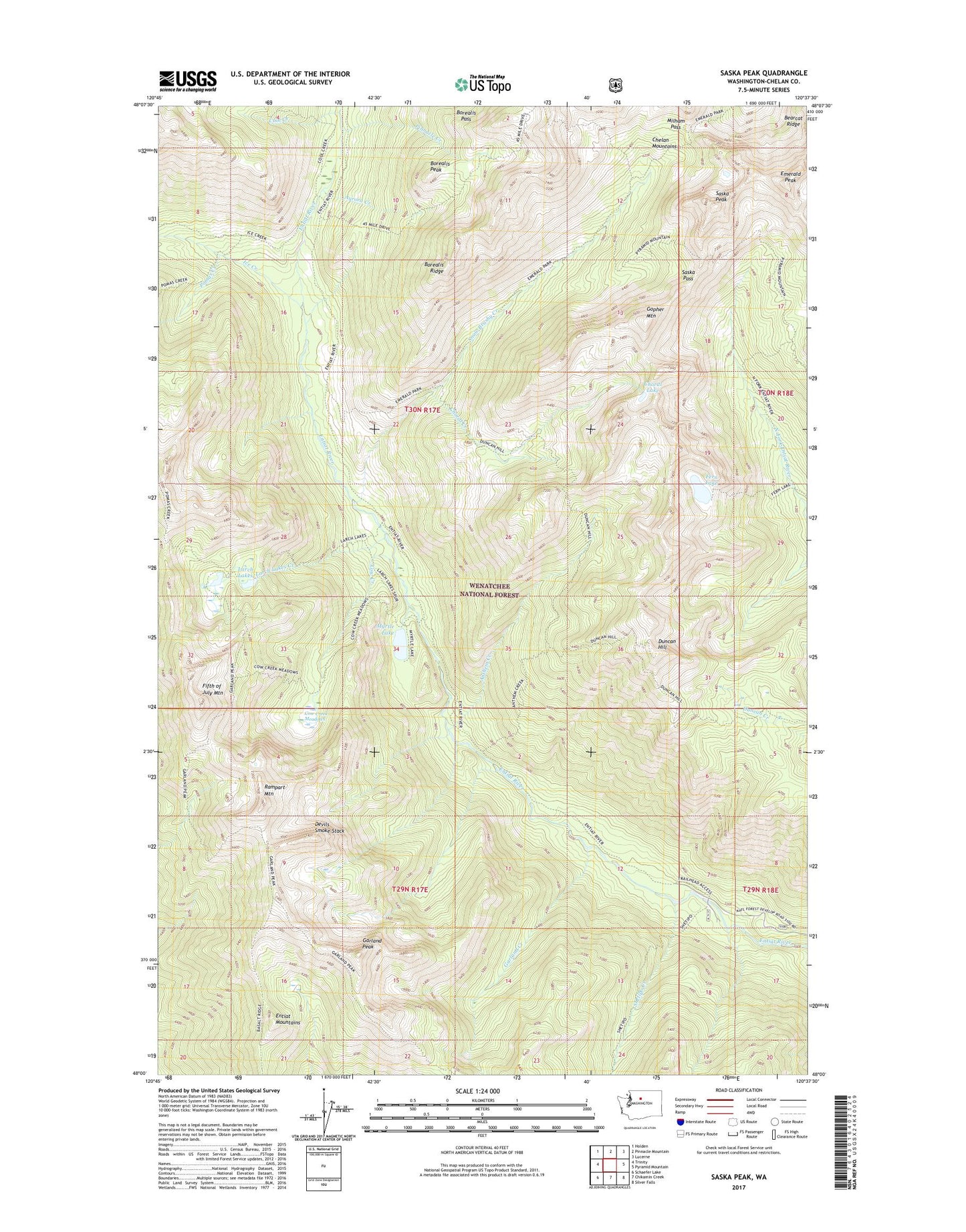
Saska Peak Washington US Topo Map
Couldn't load pickup availability
Also explore the Saska Peak Forest Service Topo of this same quad for updated USFS data
2023 topographic map quadrangle Saska Peak in the state of Washington. Scale: 1:24000. Based on the newly updated USGS 7.5' US Topo map series, this map is in the following counties: Chelan. The map contains contour data, water features, and other items you are used to seeing on USGS maps, but also has updated roads and other features. This is the next generation of topographic maps. Printed on high-quality waterproof paper with UV fade-resistant inks.
Quads adjacent to this one:
West: Trinity
Northwest: Holden
North: Pinnacle Mountain
Northeast: Lucerne
East: Pyramid Mountain
Southeast: Silver Falls
South: Chikamin Creek
Southwest: Schaefer Lake
This map covers the same area as the classic USGS quad with code o48120a6.
Contains the following named places: Anthem Creek, Aurora Creek, Bearcat Ridge, Borealis Pass, Borealis Peak, Borealis Ridge, Choral Creek, Choral Lake, Cool Creek, Cottonwood Campground, Cottonwood Guard Station, Cow Creek, Cow Creek Meadows, Devils Smoke Stack, Duncan Hill, Duncan Hill Trail, Emerald Peak, Fern Lake, Fifth of July Mountain, Garland Creek, Garland Peak, Gopher Mountain, Ice Creek, Ice Creek Camp, Ice Creek Shelter, Larch Lake Campground, Larch Lakes, Larch Lakes Creek, Milham Pass, Myrtle Lake, Pinnacle Creek, Pomas Creek, Rampart Mountain, Saska Pass, Saska Peak, Shetipo Creek, Snow Brushy Creek