MyTopo
Savage Island Washington US Topo Map
Couldn't load pickup availability
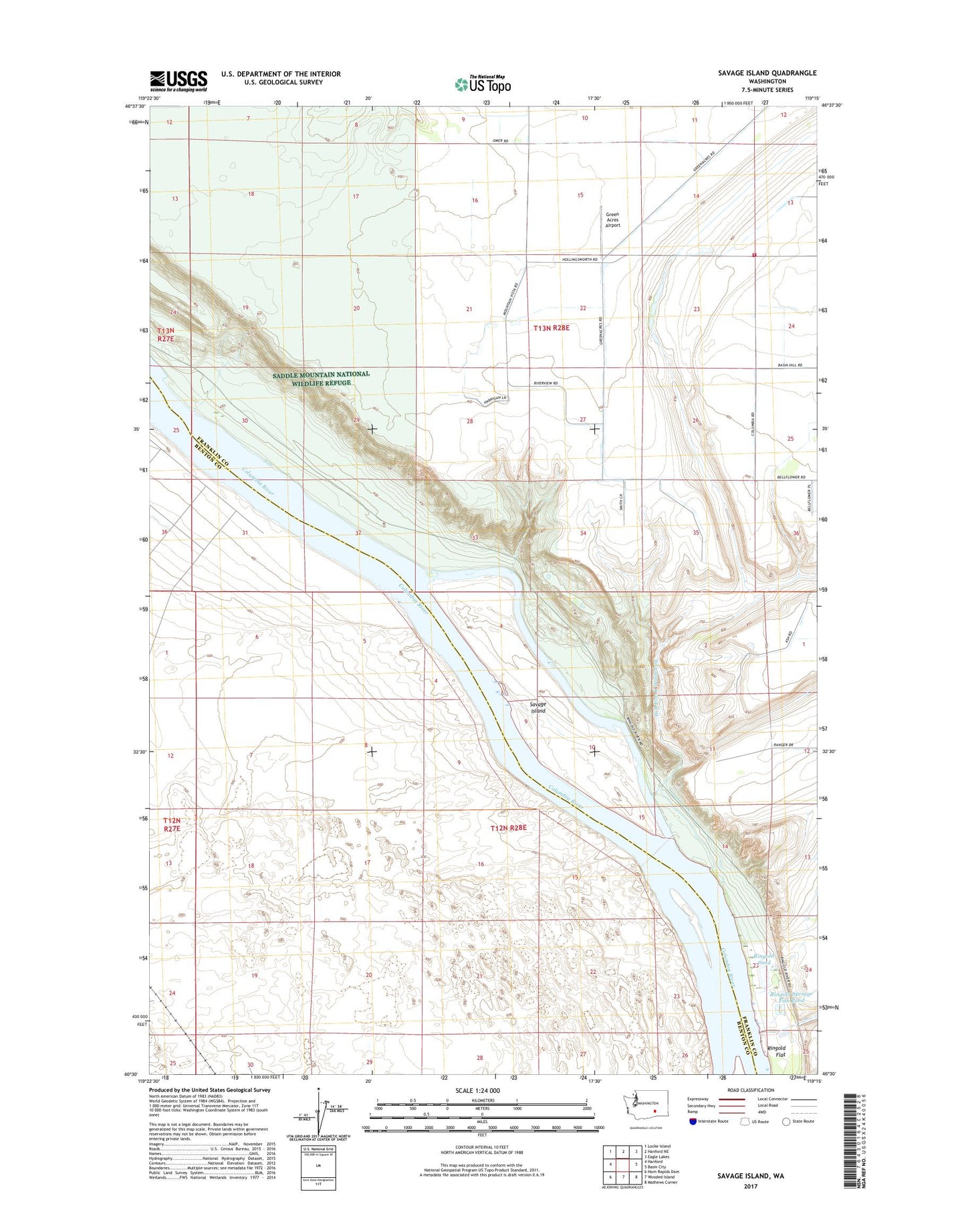
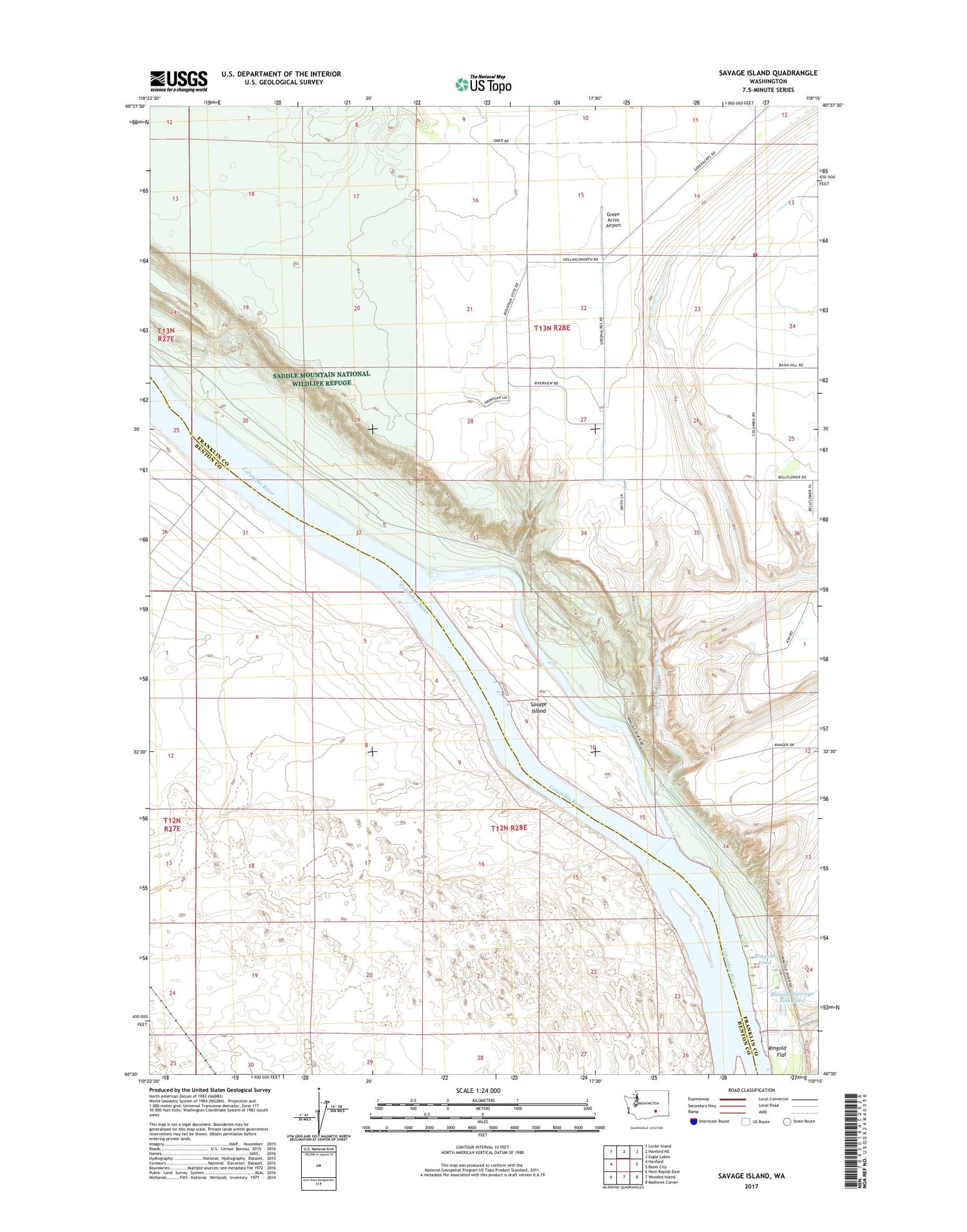
2020 topographic map quadrangle Savage Island in the state of Washington. Scale: 1:24000. Based on the newly updated USGS 7.5' US Topo map series, this map is in the following counties: Franklin, Benton. The map contains contour data, water features, and other items you are used to seeing on USGS maps, but also has updated roads and other features. This is the next generation of topographic maps. Printed on high-quality waterproof paper with UV fade-resistant inks.
Quads adjacent to this one:
West: Hanford
Northwest: Locke Island
North: Hanford NE
Northeast: Eagle Lakes
East: Basin City
Southeast: Mathews Corner
South: Wooded Island
Southwest: Horn Rapids Dam
Contains the following named places: Franklin County Fire District 4 Station 2, Green Acres Airport, Ringold Flat, Ringold Pond, Ringold Pond Dam, Ringold Springs Fish Pond, Ringold Springs Fish Pond Dam, Savage Island, W B Five K Wasteway