MyTopo
Silver Lake Washington US Topo Map
Couldn't load pickup availability
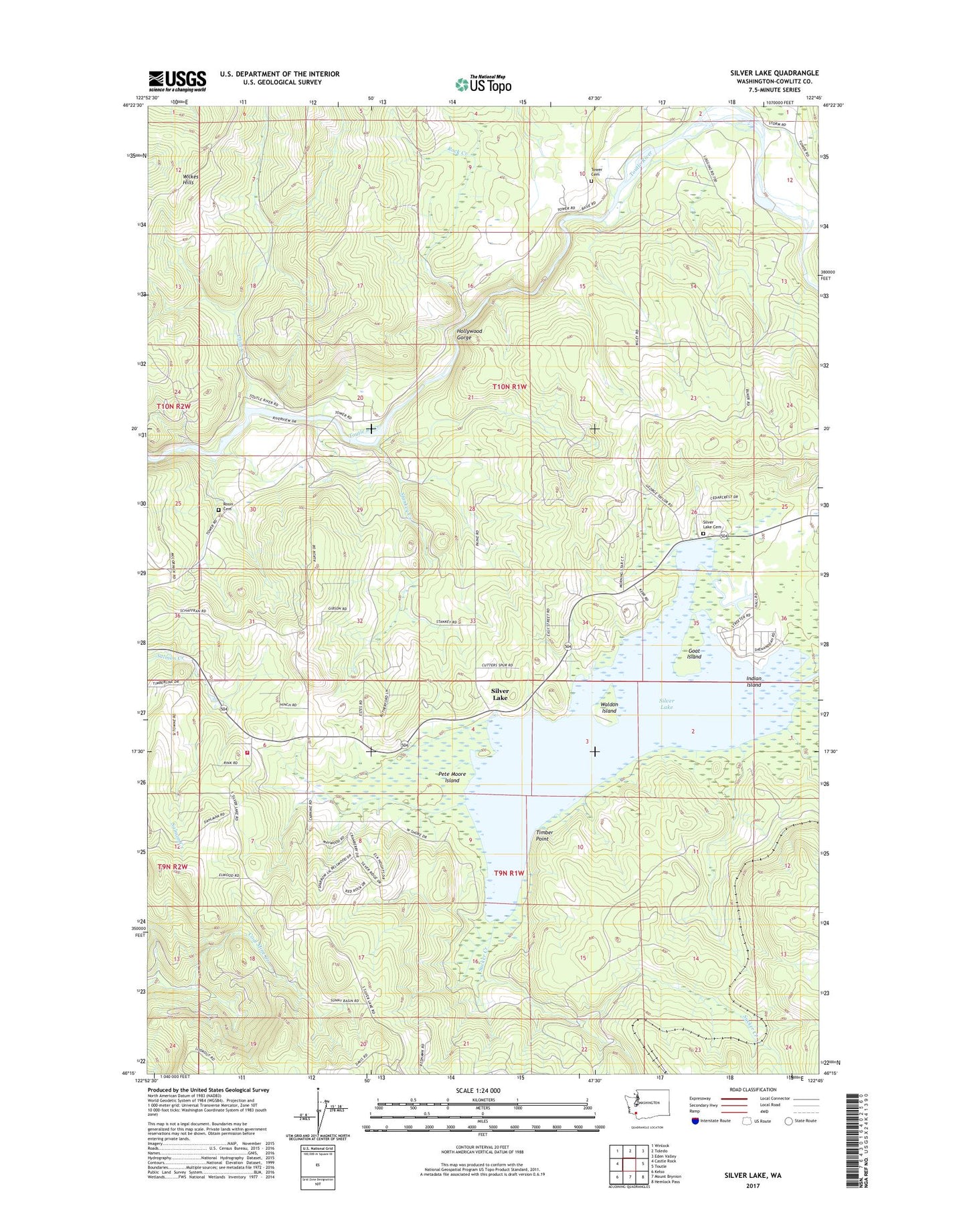
2023 topographic map quadrangle Silver Lake in the state of Washington. Scale: 1:24000. Based on the newly updated USGS 7.5' US Topo map series, this map is in the following counties: Cowlitz. The map contains contour data, water features, and other items you are used to seeing on USGS maps, but also has updated roads and other features. This is the next generation of topographic maps. Printed on high-quality waterproof paper with UV fade-resistant inks.
Quads adjacent to this one:
West: Castle Rock
Northwest: Winlock
North: Toledo
Northeast: Eden Valley
East: Toutle
Southeast: Hemlock Pass
South: Mount Brynion
Southwest: Kelso
This map covers the same area as the classic USGS quad with code o46122c7.
Contains the following named places: Camp Cowlitz, Cline Creek, Cowlitz County Fire District 3 Castle Rock Substation, Goat Island, Hollywood Gorge, Indian Island, Pete Moore Island, Rock Creek, Rosin Cemetery, Seaquest State Park, Seven Wonders Museum, Silver Lake, Silver Lake Cemetery, Stankey Creek, Sucker Creek, Timber Point, Tower Township Cemetery, Waldon Island, ZIP Code: 98645