MyTopo
Eden Valley Washington US Topo Map
Couldn't load pickup availability
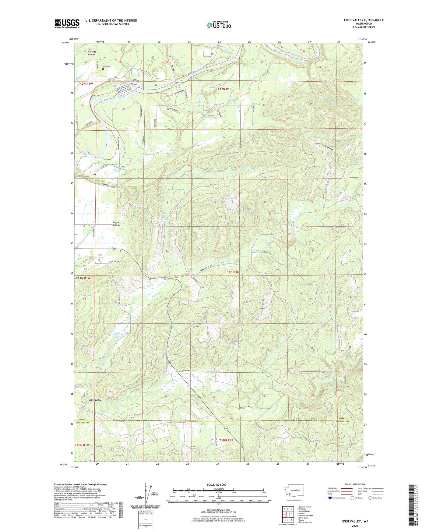
2023 topographic map quadrangle Eden Valley in the state of Washington. Scale: 1:24000. Based on the newly updated USGS 7.5' US Topo map series, this map is in the following counties: Lewis, Cowlitz. The map contains contour data, water features, and other items you are used to seeing on USGS maps, but also has updated roads and other features. This is the next generation of topographic maps. Printed on high-quality waterproof paper with UV fade-resistant inks.
Quads adjacent to this one:
West: Toledo
Northwest: Jackson Prairie
North: Onalaska
Northeast: Mayfield Lake
East: Hatchet Mountain
Southeast: Toutle Mountain
South: Toutle
Southwest: Silver Lake
This map covers the same area as the classic USGS quad with code o46122d6.
Contains the following named places: Alexander Creek, Blue Creek, Cedar Creek, Cedar Creek Falls, Cowlitz Trout Hatchery, Eden Valley, Ferteg Creek, Ike Cemetery, Jack Welches Creek, Lewis County Fire District 2 Station 3, North Fork Cedar Creek, Otter Creek, Swan Creek, Windom Mine, ZIP Code: 98591