MyTopo
Siouxon Peak Washington US Topo Map
Couldn't load pickup availability
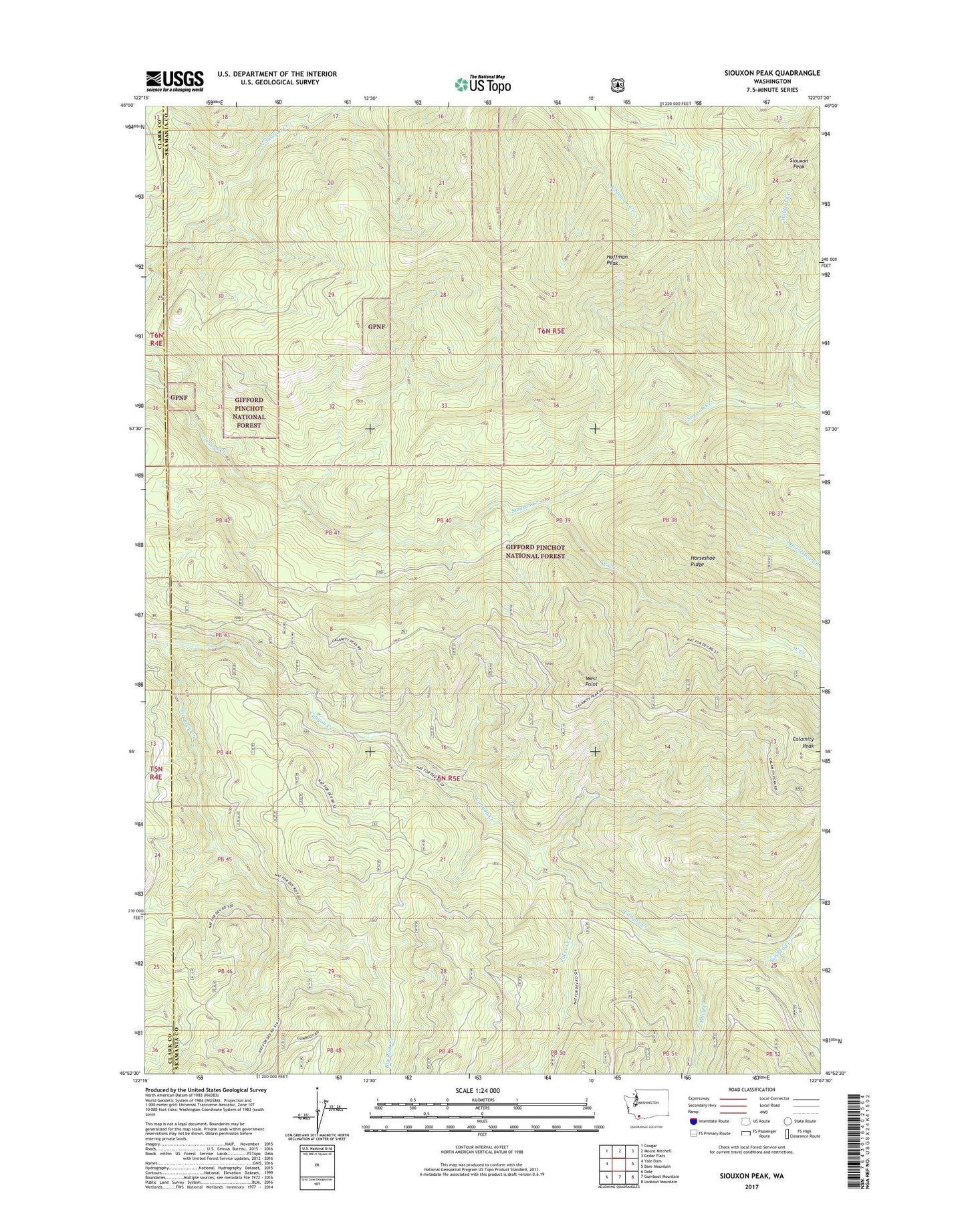
2020 topographic map quadrangle Siouxon Peak in the state of Washington. Scale: 1:24000. Based on the newly updated USGS 7.5' US Topo map series, this map is in the following counties: Skamania, Clark. The map contains contour data, water features, and other items you are used to seeing on USGS maps, but also has updated roads and other features. This is the next generation of topographic maps. Printed on high-quality waterproof paper with UV fade-resistant inks.
Quads adjacent to this one:
West: Yale Dam
Northwest: Cougar
North: Mount Mitchell
Northeast: Cedar Flats
East: Bare Mountain
Southeast: Lookout Mountain
South: Gumboot Mountain
Southwest: Dole
Contains the following named places: Big Rock Creek, Calamity Peak, Canyon Creek Campground, Canyon Creek Trail, Hackamore Creek, Hickmans Cabin, Horseshoe Creek, Horseshoe Ridge Trail, Huffman Peak, Huffman Peak Lookout, Jakes Creek, Pelvy Creek, Siouxon Peak, Siouxon Peak Lookout, Siouxon Trail, Sorehead Creek, West Creek, West Point, West Point Lookout, Wildcat Creek