MyTopo
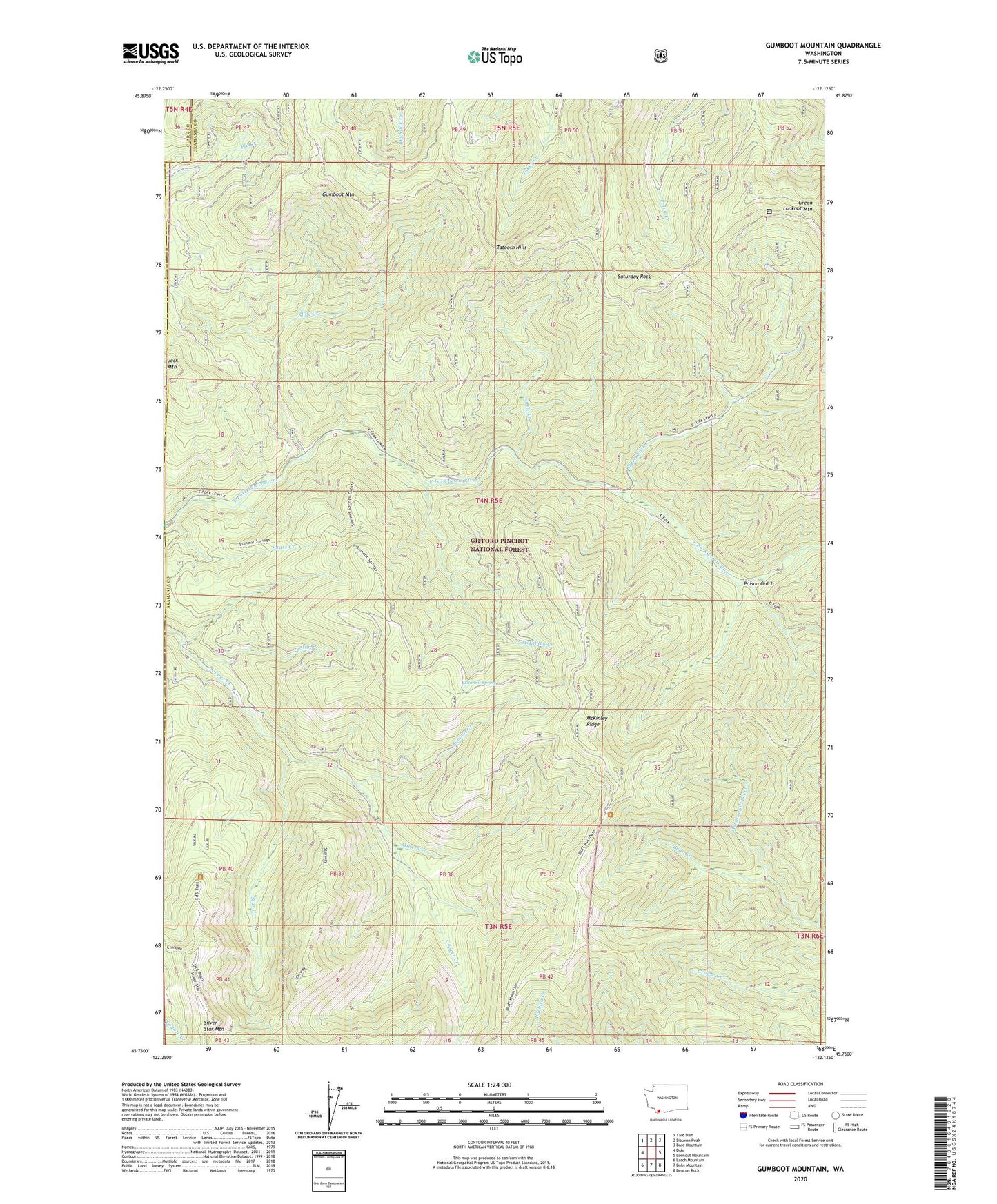
Gumboot Mountain Washington US Topo Map
Couldn't load pickup availability
Also explore the Gumboot Mountain Forest Service Topo of this same quad for updated USFS data
2023 topographic map quadrangle Gumboot Mountain in the state of Washington. Scale: 1:24000. Based on the newly updated USGS 7.5' US Topo map series, this map is in the following counties: Skamania, Clark. The map contains contour data, water features, and other items you are used to seeing on USGS maps, but also has updated roads and other features. This is the next generation of topographic maps. Printed on high-quality waterproof paper with UV fade-resistant inks.
Quads adjacent to this one:
West: Dole
Northwest: Yale Dam
North: Siouxon Peak
Northeast: Bare Mountain
East: Lookout Mountain
Southeast: Beacon Rock
South: Bobs Mountain
Southwest: Larch Mountain
This map covers the same area as the classic USGS quad with code o45122g2.
Contains the following named places: Bear Creek, Bolin Creek, Doughgob Camp, Green Fork, Gumboot Mountain, Little Creek, Lookout Creek, McKinley Creek, McKinley Ridge, Miners Creek, Poison Gulch, Saturday Rock, Slide Creek, Star Creek, Summit Creek, Summit Spring, Sunset Campground, Tatoosh Hills, Washougal Trail