MyTopo
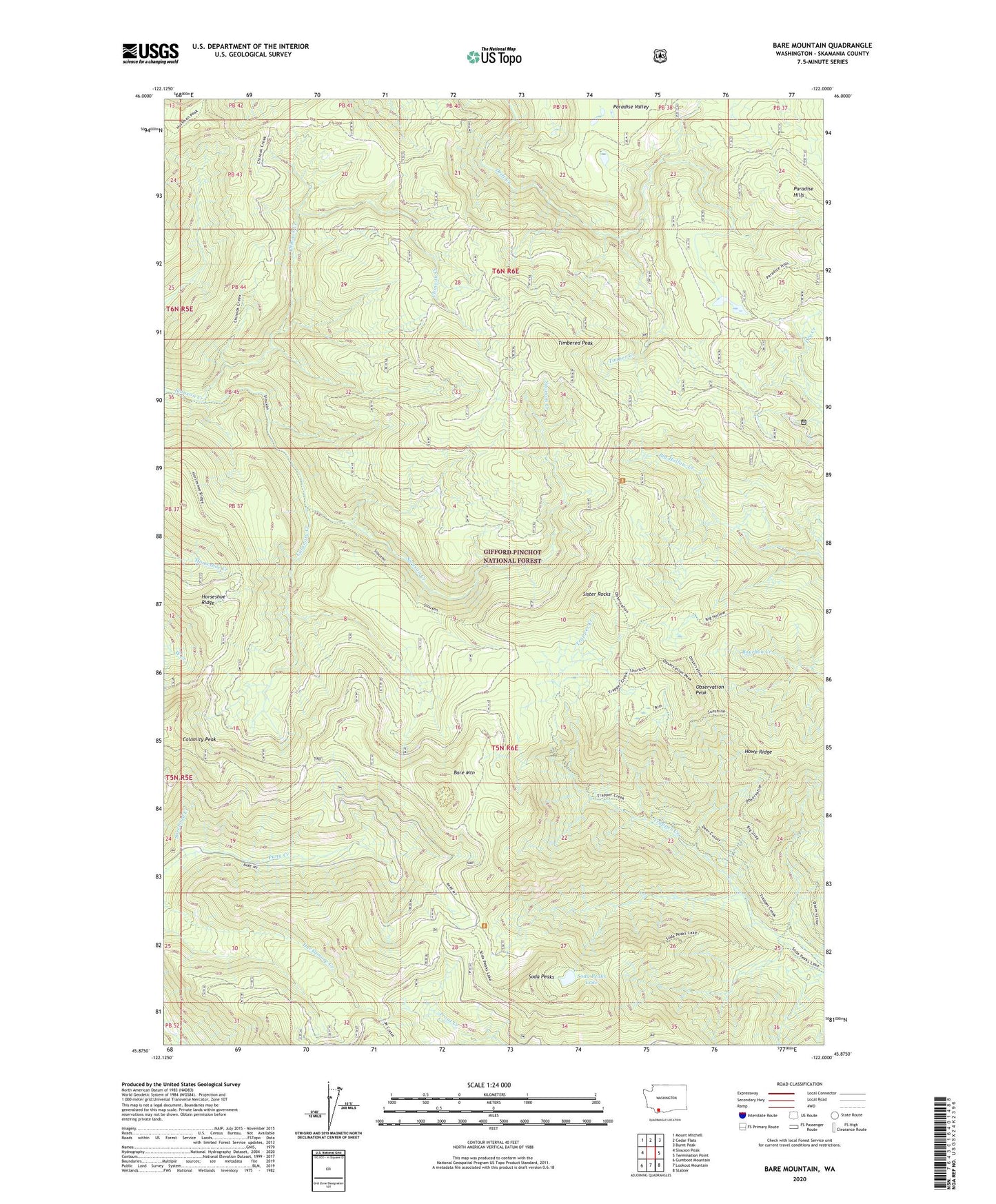
Bare Mountain Washington US Topo Map
Couldn't load pickup availability
Also explore the Bare Mountain Forest Service Topo of this same quad for updated USFS data
2023 topographic map quadrangle Bare Mountain in the state of Washington. Scale: 1:24000. Based on the newly updated USGS 7.5' US Topo map series, this map is in the following counties: Skamania. The map contains contour data, water features, and other items you are used to seeing on USGS maps, but also has updated roads and other features. This is the next generation of topographic maps. Printed on high-quality waterproof paper with UV fade-resistant inks.
Quads adjacent to this one:
West: Siouxon Peak
Northwest: Mount Mitchell
North: Cedar Flats
Northeast: Burnt Peak
East: Termination Point
Southeast: Stabler
South: Lookout Mountain
Southwest: Gumboot Mountain
This map covers the same area as the classic USGS quad with code o45122h1.
Contains the following named places: Bare Mountain, Calamity Creek, Calamity Peak Trail, Chinook Creek, Horseshoe Ridge, Observation Berryfield Campground, Observation Peak, Observation Peak Lookout, Observation Peak Trail, Paradise Hills, Puny Creek, Ridge Trail, Sister Rocks, Sister Rocks Research Natural Area, Soda Peaks, Soda Peaks Lake, Timber Creek, Timbered Peak, Trapper Creek Wilderness