MyTopo
Skamokawa Pass Washington US Topo Map
Couldn't load pickup availability
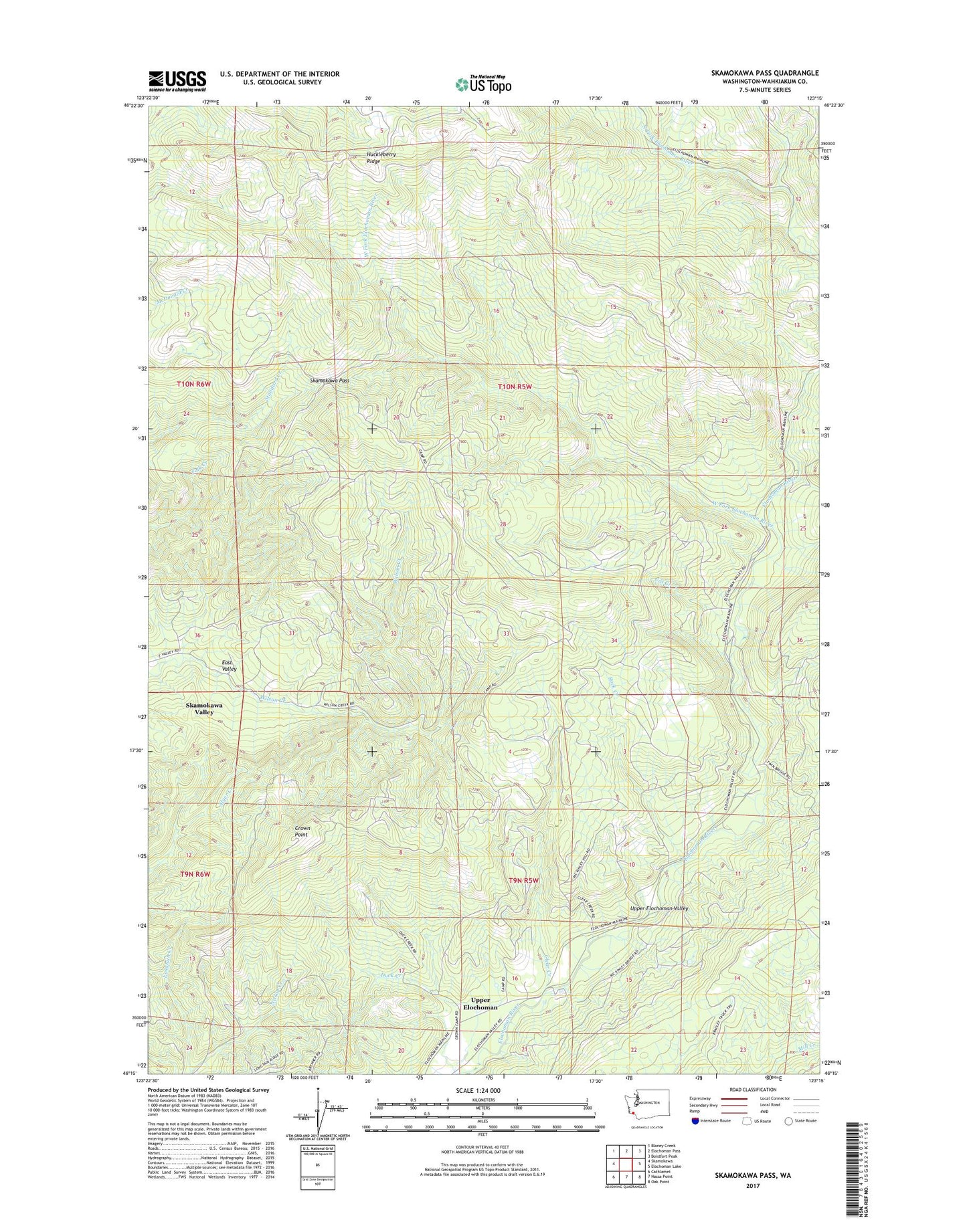
2023 topographic map quadrangle Skamokawa Pass in the state of Washington. Scale: 1:24000. Based on the newly updated USGS 7.5' US Topo map series, this map is in the following counties: Wahkiakum. The map contains contour data, water features, and other items you are used to seeing on USGS maps, but also has updated roads and other features. This is the next generation of topographic maps. Printed on high-quality waterproof paper with UV fade-resistant inks.
Quads adjacent to this one:
West: Skamokawa
Northwest: Blaney Creek
North: Elochoman Pass
Northeast: Boistfort Peak
East: Elochoman Lake
Southeast: Oak Point
South: Nassa Point
Southwest: Cathlamet
This map covers the same area as the classic USGS quad with code o46123c3.
Contains the following named places: Bradley Truck Trail, Camp 2, Cat Creek, Clear Creek, Crown Point, Duck Creek, Elochoman Hatchery, Family Camp, Huckleberry Ridge, Longtain Creek, Rock Creek, Skamokawa Division, Skamokawa Pass, Skamokawa Truck Trail, West Fork Elochoman River