MyTopo
Skokomish Valley Washington US Topo Map
Couldn't load pickup availability
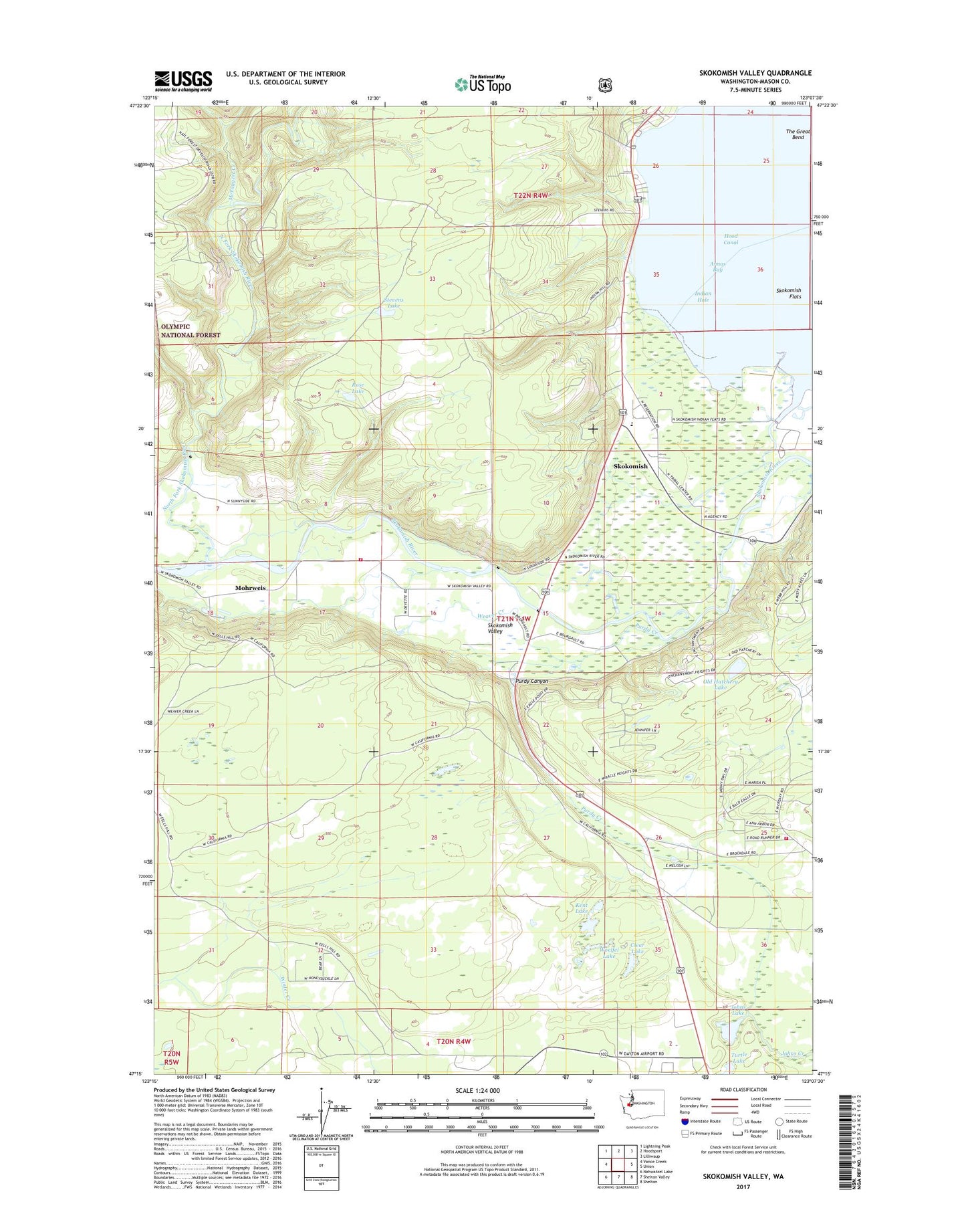
2020 topographic map quadrangle Skokomish Valley in the state of Washington. Scale: 1:24000. Based on the newly updated USGS 7.5' US Topo map series, this map is in the following counties: Mason. The map contains contour data, water features, and other items you are used to seeing on USGS maps, but also has updated roads and other features. This is the next generation of topographic maps. Printed on high-quality waterproof paper with UV fade-resistant inks.
Quads adjacent to this one:
West: Vance Creek
Northwest: Lightning Peak
North: Hoodsport
Northeast: Lilliwaup
East: Union
Southeast: Shelton
South: Shelton Valley
Southwest: Nahwatzel Lake
Contains the following named places: Annas Bay, Brockdale, Church of Christ, Clear Lake, Frigid Creek, George Adams Salmon Hatchery, Hood Canal Elementary - Junior High School, Hood Canal Recreation Park Picnic Area, Hunter Creek, Indian Hole, Indian School, Johns Lake, Kent Lake, Mason County, Mason County Fire District 9, Mason County Medic One Ambulance Service, McTaggert Creek, Minerva Beach Mobile Village Resort, Mohrweis, Mussel Shell Creek, North Fork Skokomish River, Old Hatchery Lake, Potlatch State Park, Potlatch State Park Campground, Purdy Canyon, Purdy Creek, Rose Lake, Shelton Trout Hatchery, Skokomish, Skokomish Census Designated Place, Skokomish Community Church, Skokomish Reservation, Skokomish Reservation Division, Skokomish Valley School, South Fork Skokomish River, Stevens Lake, Turtle Lake, Washington State Patrol Academy, Weaver Creek, Woelfel Lake