MyTopo
Steamboat Rock SE Washington US Topo Map
Couldn't load pickup availability
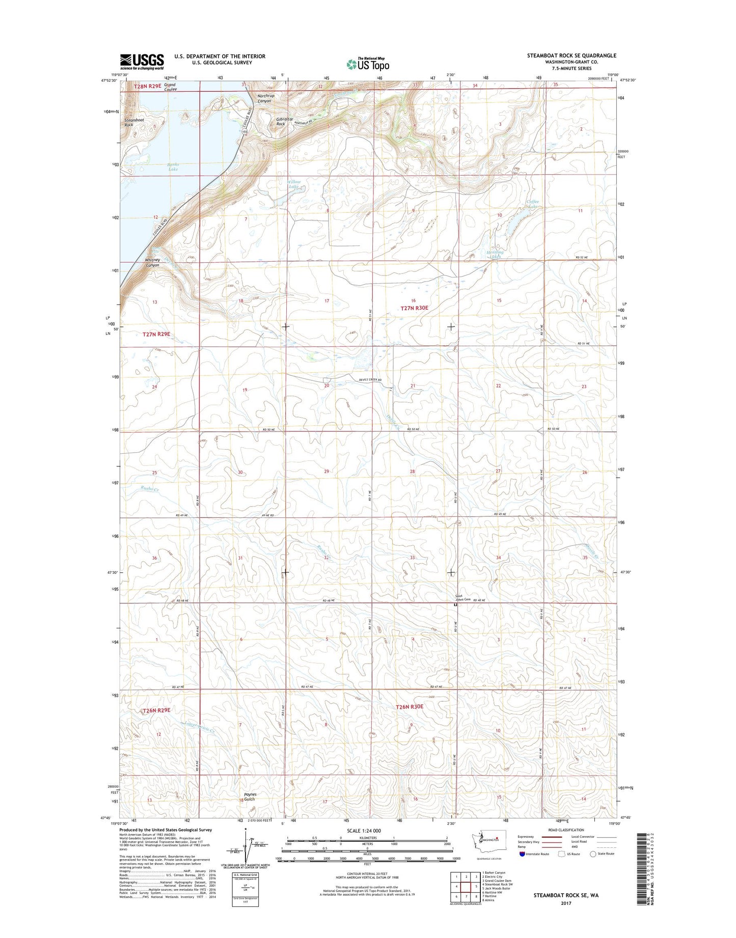
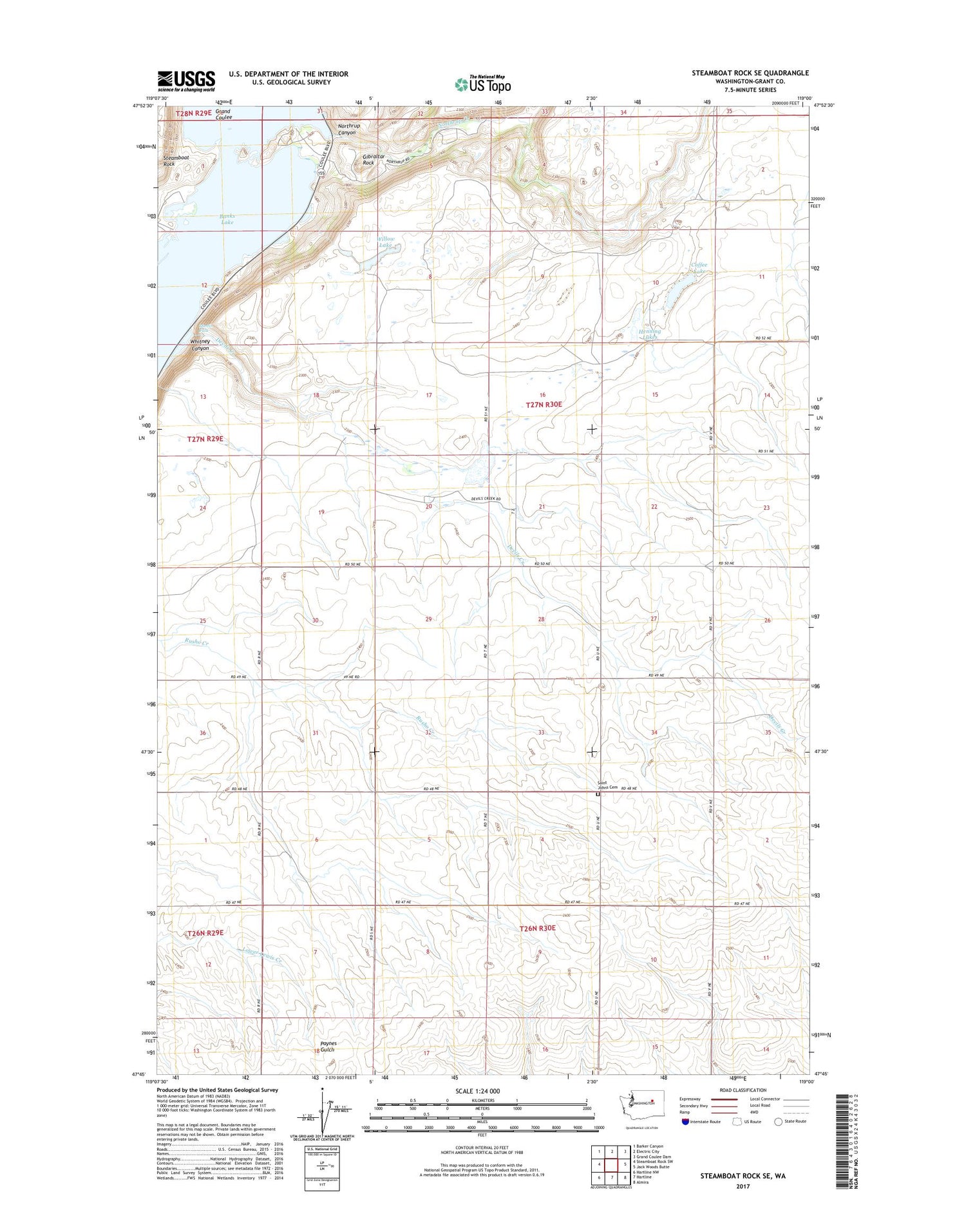
2020 topographic map quadrangle Steamboat Rock SE in the state of Washington. Scale: 1:24000. Based on the newly updated USGS 7.5' US Topo map series, this map is in the following counties: Grant. The map contains contour data, water features, and other items you are used to seeing on USGS maps, but also has updated roads and other features. This is the next generation of topographic maps. Printed on high-quality waterproof paper with UV fade-resistant inks.
Quads adjacent to this one:
West: Steamboat Rock SW
Northwest: Barker Canyon
North: Electric City
Northeast: Grand Coulee Dam
East: Jack Woods Butte
Southeast: Almira
South: Hartline
Southwest: Hartline NW
Contains the following named places: Coffee Lake, Devils Creek, Devils Punch Bowl, Gibraltar Rock, Henning Lakes, Martin Falls, Northrup Canyon, Northrup Canyon State Park, Northrup Creek, Saint Johns Cemetery, Whitney Canyon, Willow Lake