MyTopo
Electric City Washington US Topo Map
Couldn't load pickup availability
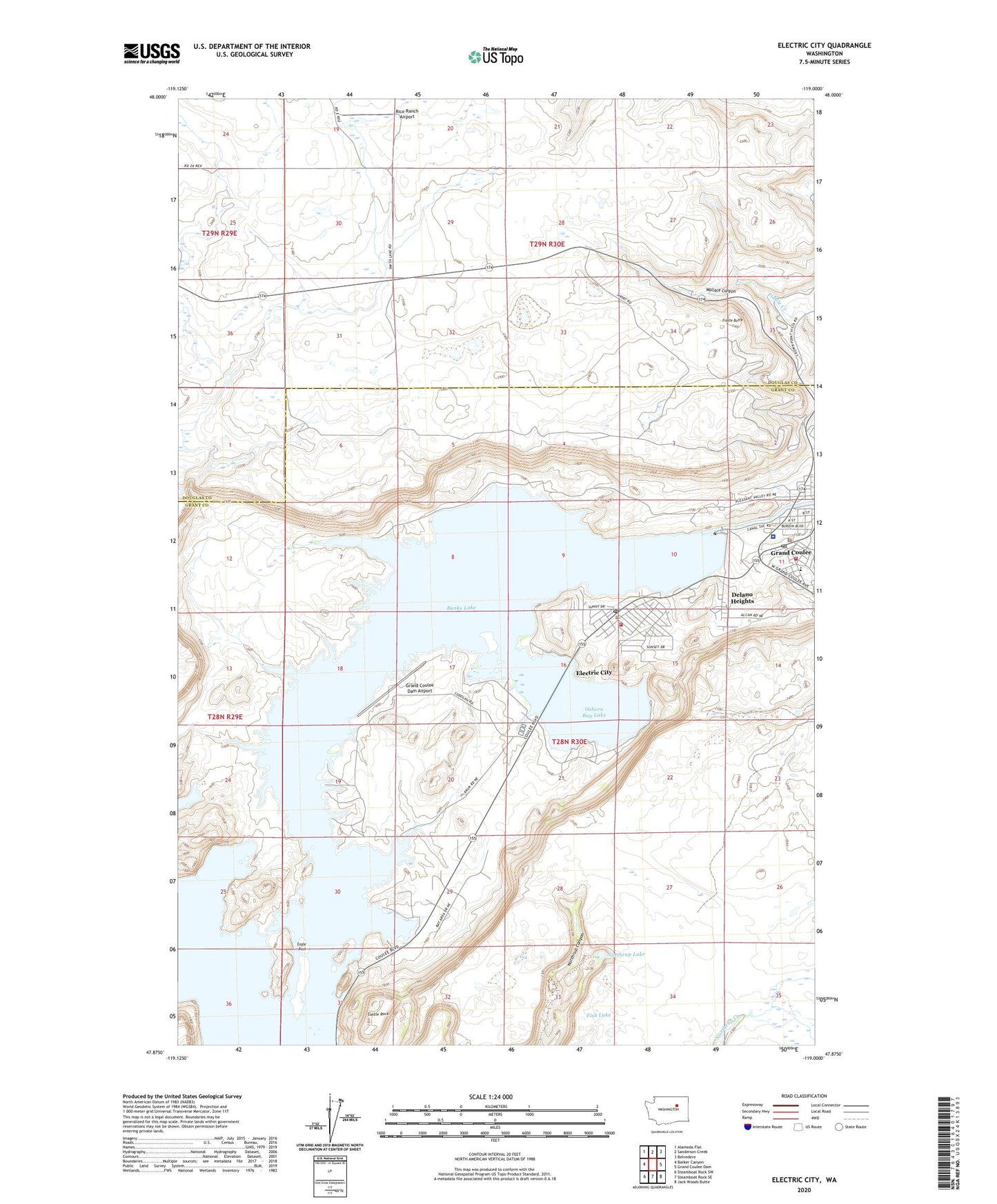
2023 topographic map quadrangle Electric City in the state of Washington. Scale: 1:24000. Based on the newly updated USGS 7.5' US Topo map series, this map is in the following counties: Grant, Douglas. The map contains contour data, water features, and other items you are used to seeing on USGS maps, but also has updated roads and other features. This is the next generation of topographic maps. Printed on high-quality waterproof paper with UV fade-resistant inks.
Quads adjacent to this one:
West: Barker Canyon
Northwest: Alameda Flat
North: Sanderson Creek
Northeast: Belvedere
East: Grand Coulee Dam
Southeast: Jack Woods Butte
South: Steamboat Rock SE
Southwest: Steamboat Rock SW
This map covers the same area as the classic USGS quad with code o47119h1.
Contains the following named places: Banks Lake North Dam, Castle Rock, Center Elementary School, City of Electric City, City of Grand Coulee, Coulee Community Hospital, Coulee Community Hospital Heliport, Coulee Playfield, Delano Heights, Eagle Rock, Electric City, Electric City Fire Department, Electric City Post Office, Fiddle Butte, Fish Lake, Grand Coulee, Grand Coulee Adventist Church, Grand Coulee Dam Airport, Grand Coulee Dam Junior High School, Grand Coulee Division, Grand Coulee Fire Department, Grand Coulee Police Department, Grand Coulee Post Office, KEYG-AM (Grand Coulee), North Dam, North Park, Northrup Lake, Osborn Bay Lake, Osborne, Rice Ranch Airport, Wallace Canyon