MyTopo
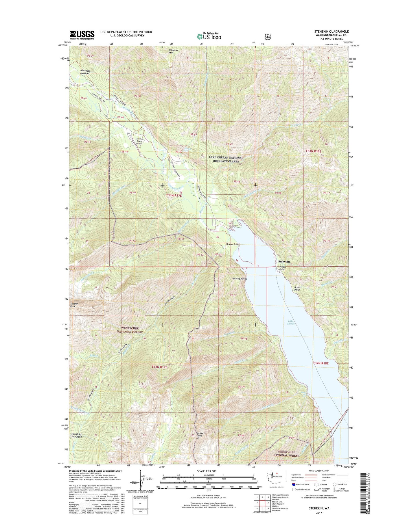
Stehekin Washington US Topo Map
Couldn't load pickup availability
Also explore the Stehekin Forest Service Topo of this same quad for updated USFS data
2023 topographic map quadrangle Stehekin in the state of Washington. Scale: 1:24000. Based on the newly updated USGS 7.5' US Topo map series, this map is in the following counties: Chelan. The map contains contour data, water features, and other items you are used to seeing on USGS maps, but also has updated roads and other features. This is the next generation of topographic maps. Printed on high-quality waterproof paper with UV fade-resistant inks.
Quads adjacent to this one:
West: Mount Lyall
Northwest: McGregor Mountain
North: McAlester Mountain
Northeast: Gilbert
East: Sun Mountain
Southeast: Lucerne
South: Pinnacle Mountain
Southwest: Holden
This map covers the same area as the classic USGS quad with code o48120c6.
Contains the following named places: Adams Point, Battalion Creek, Bird Creek, Bird Creek Camp, Blackberry Creek, Boulder Creek, Bridal Veil Creek, Bridal Veil Falls, Canyon Creek, Castle Creek, Castle Rock, Company Creek, Devore Creek, Flick Creek, Fourmile Creek, Golden West Visitor Center and Ranger Station, Harlequin Campground, Hazard Creek, Lake Chelan National Recreation Area, Little Boulder Creek, Manley Wham Campground, Margerum Creek, McGregor Meadows, Onemile Creek, Painted Rocks, Purple Creek, Purple Point, Purple Point Campground, Rainbow Bridge Campsite, Rainbow Creek, Rainbow Falls, Rainbow Falls Campground, Rainbow Ford Campsite, Rainbow Mountain, Riddle Creek, Stehekin, Stehekin Boat Launch, Stehekin Campground, Stehekin Division, Stehekin Ferry Landing, Stehekin River, Stehekin State Airport, Weaver Point, Weaver Point Campground, West Fork Devore Creek