MyTopo
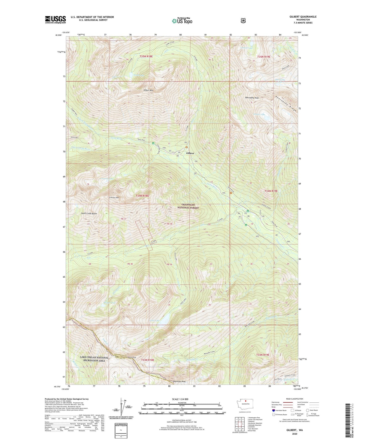
Gilbert Washington US Topo Map
Couldn't load pickup availability
Also explore the Gilbert Forest Service Topo of this same quad for updated USFS data
2023 topographic map quadrangle Gilbert in the state of Washington. Scale: 1:24000. Based on the newly updated USGS 7.5' US Topo map series, this map is in the following counties: Okanogan, Chelan. The map contains contour data, water features, and other items you are used to seeing on USGS maps, but also has updated roads and other features. This is the next generation of topographic maps. Printed on high-quality waterproof paper with UV fade-resistant inks.
Quads adjacent to this one:
West: McAlester Mountain
Northwest: Washington Pass
North: Silver Star Mountain
Northeast: Mazama
East: Midnight Mountain
Southeast: Oval Peak
South: Sun Mountain
Southwest: Stehekin
This map covers the same area as the classic USGS quad with code o48120d5.
Contains the following named places: Abernathy Lake, Abernathy Peak, Abernathy Ridge, Bugger Lake, Crescent Lake, Crescent Mine, Crescent Mountain, Gibert Mountain, Gilbert, Gilbert Trailhead, Lamont Lake, Louis Creek, Louis Lake, North Creek, North Fork Twisp River, North Lake, Rennie Peak, Reynolds Peak, Roads End Campground, Scatter Creek, Scatter Lake, South Creek, South Creek Butte, South Creek Campground, South Fork South Creek, South Fork Twisp River, Twisp River Trailhead