MyTopo
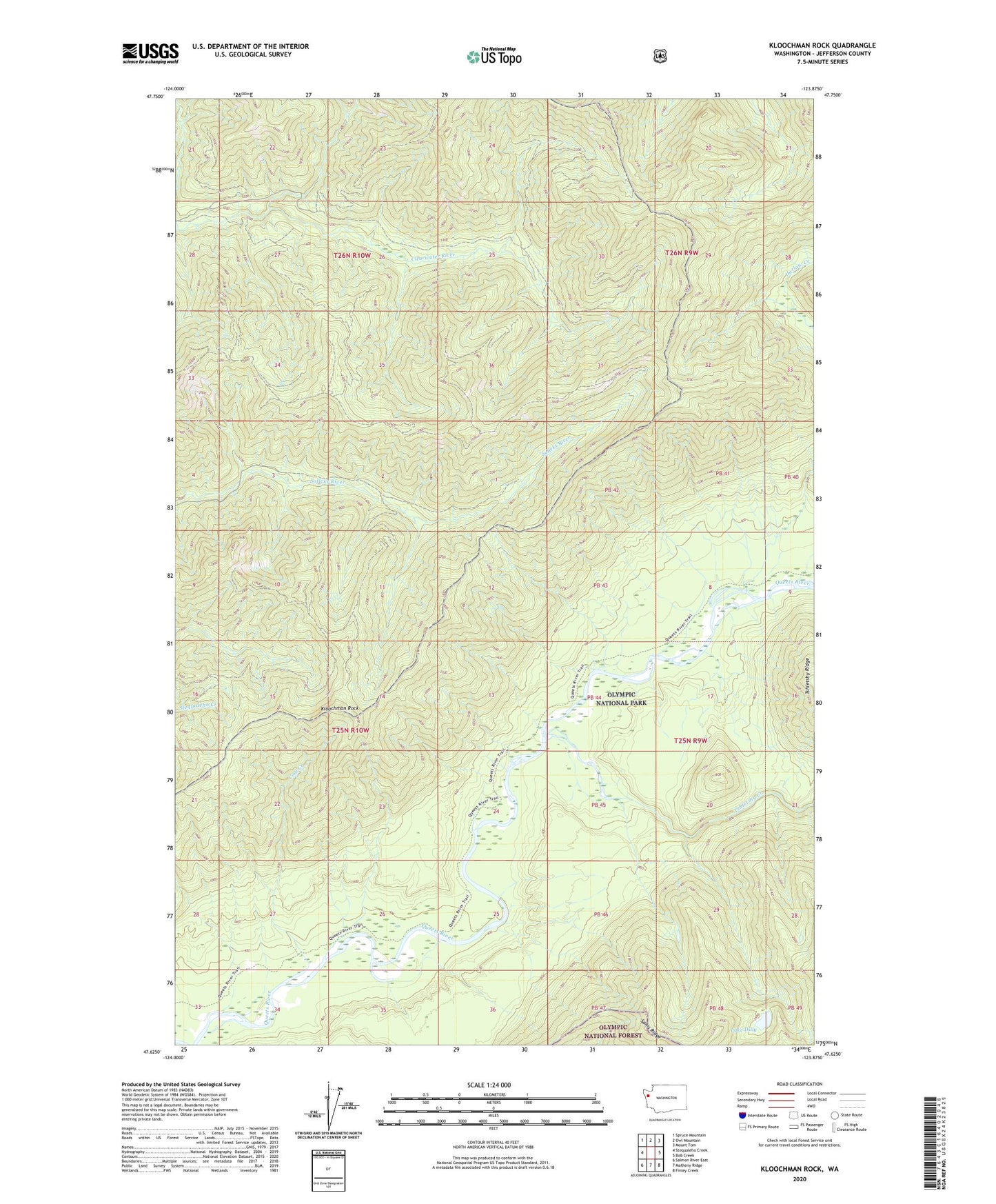
Kloochman Rock Washington US Topo Map
Couldn't load pickup availability
Also explore the Kloochman Rock Forest Service Topo of this same quad for updated USFS data
2023 topographic map quadrangle Kloochman Rock in the state of Washington. Scale: 1:24000. Based on the newly updated USGS 7.5' US Topo map series, this map is in the following counties: Jefferson. The map contains contour data, water features, and other items you are used to seeing on USGS maps, but also has updated roads and other features. This is the next generation of topographic maps. Printed on high-quality waterproof paper with UV fade-resistant inks.
Quads adjacent to this one:
West: Stequaleho Creek
Northwest: Spruce Mountain
North: Owl Mountain
Northeast: Mount Tom
East: Bob Creek
Southeast: Finley Creek
South: Matheny Ridge
Southwest: Salmon River East
This map covers the same area as the classic USGS quad with code o47123f8.
Contains the following named places: Coal Creek, Harlow Creek, Kloochman Rock, Kloochman Rock Lookout, Lake Dilly, Smith Place, Spruce Bottom Shelter, Tshletshy Creek