MyTopo
Stray Gulch Washington US Topo Map
Couldn't load pickup availability
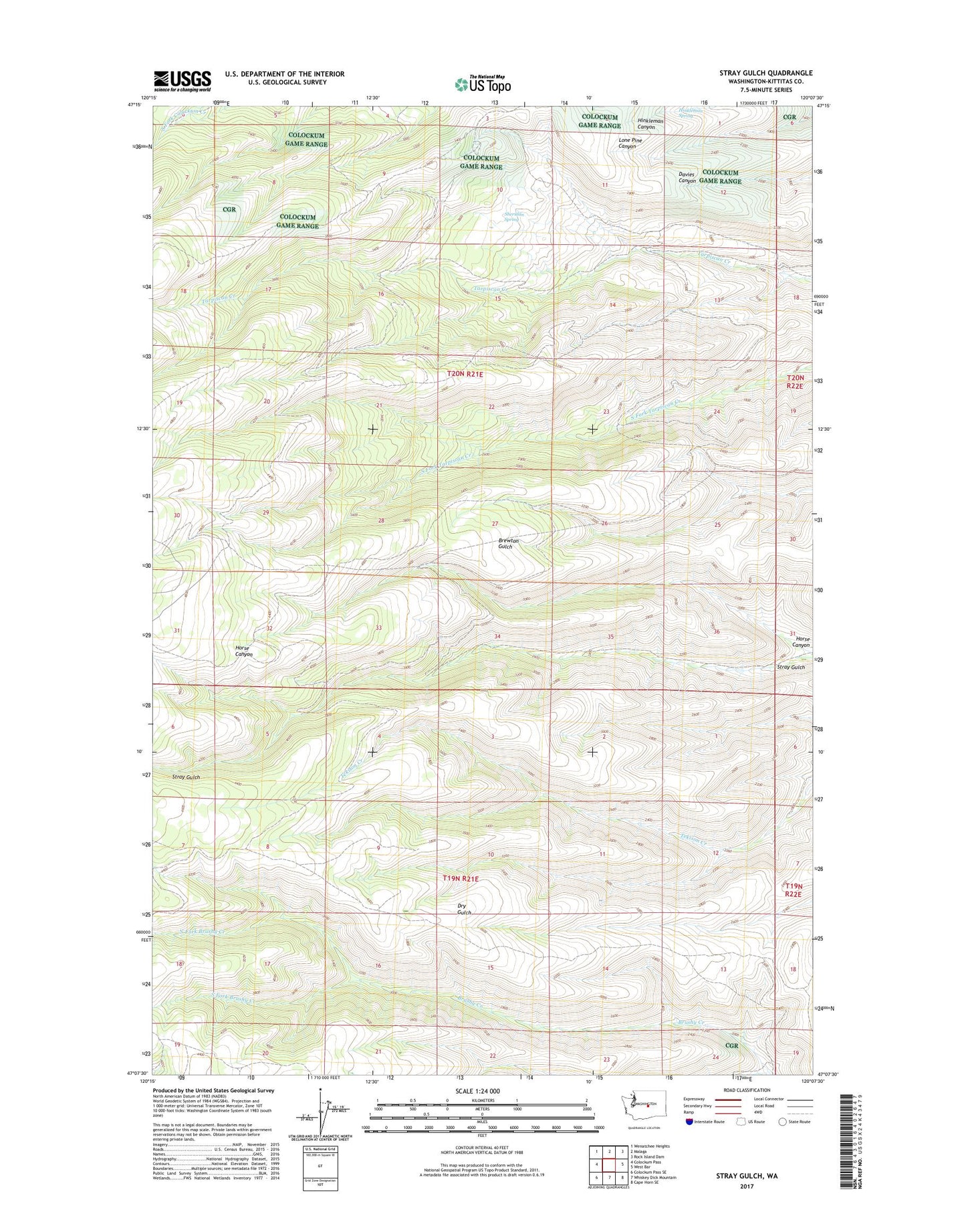
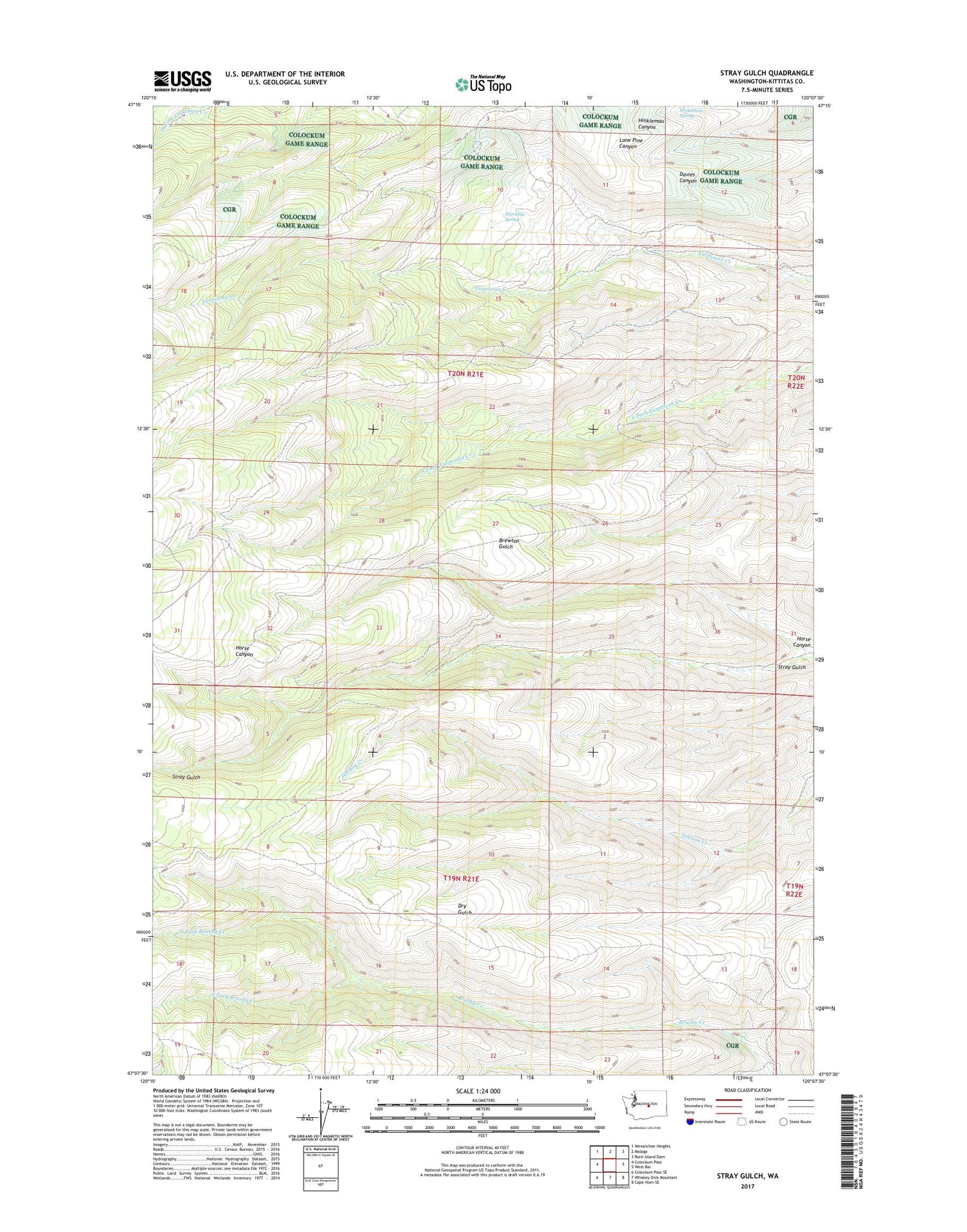
2020 topographic map quadrangle Stray Gulch in the state of Washington. Scale: 1:24000. Based on the newly updated USGS 7.5' US Topo map series, this map is in the following counties: Kittitas. The map contains contour data, water features, and other items you are used to seeing on USGS maps, but also has updated roads and other features. This is the next generation of topographic maps. Printed on high-quality waterproof paper with UV fade-resistant inks.
Quads adjacent to this one:
West: Colockum Pass
Northwest: Wenatchee Heights
North: Malaga
Northeast: Rock Island Dam
East: West Bar
Southeast: Cape Horn SE
South: Whiskey Dick Mountain
Southwest: Colockum Pass SE
Contains the following named places: Hinkleman Spring, Horse Canyon, Little Brushy Creek, North Fork Brushy Creek, Sheridan Spring, South Fork Brushy Creek