MyTopo
Foster Coulee Washington US Topo Map
Couldn't load pickup availability
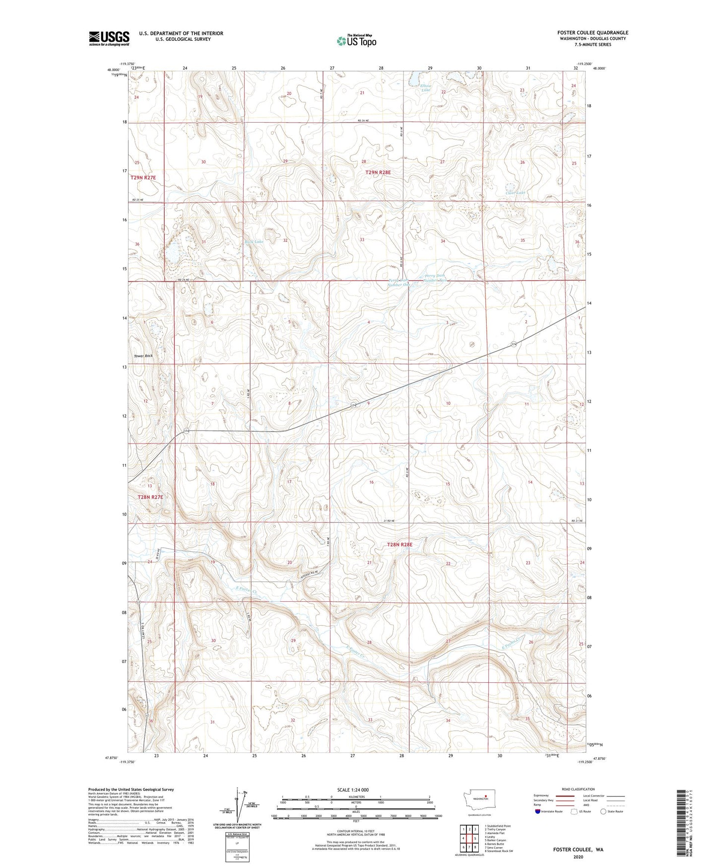
2023 topographic map quadrangle Foster Coulee in the state of Washington. Scale: 1:24000. Based on the newly updated USGS 7.5' US Topo map series, this map is in the following counties: Douglas. The map contains contour data, water features, and other items you are used to seeing on USGS maps, but also has updated roads and other features. This is the next generation of topographic maps. Printed on high-quality waterproof paper with UV fade-resistant inks.
Quads adjacent to this one:
West: Leahy
Northwest: Stubblefield Point
North: Trefry Canyon
Northeast: Alameda Flat
East: Barker Canyon
Southeast: Steamboat Rock SW
South: Sims Corner
Southwest: Barnes Butte
This map covers the same area as the classic USGS quad with code o47119h3.
Contains the following named places: Buck Lake, Clear Lake, Elbow Lake, Foster Coulee, Perry Dam Number One, Perry Dam Number Two, Tower Rock