MyTopo
Sulphur Spring Washington US Topo Map
Couldn't load pickup availability
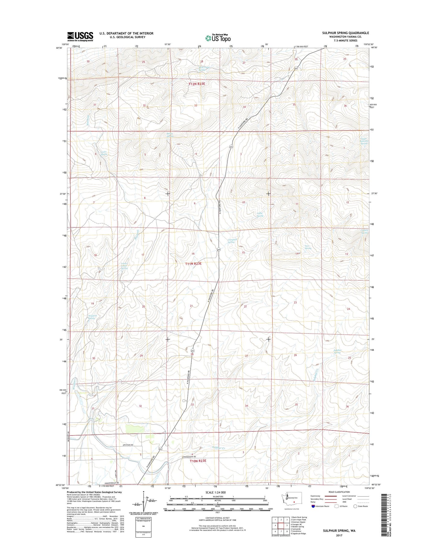
2023 topographic map quadrangle Sulphur Spring in the state of Washington. Scale: 1:24000. Based on the newly updated USGS 7.5' US Topo map series, this map is in the following counties: Yakima. The map contains contour data, water features, and other items you are used to seeing on USGS maps, but also has updated roads and other features. This is the next generation of topographic maps. Printed on high-quality waterproof paper with UV fade-resistant inks.
Quads adjacent to this one:
West: Granger NE
Northwest: Black Rock Spring
North: Cairn Hope Peak
Northeast: Emerson Nipple
East: Maiden Spring
Southeast: Sagebrush Ridge
South: Grandview
Southwest: Sunnyside
This map covers the same area as the classic USGS quad with code o46119d8.
Contains the following named places: Bailey Spring, Buck Camp Spring, Campbell Spring, Canyon Spring, Colby Spring, Lower Lozier Spring, Lozier Spring, Pump Station Number 10, Sulphur Creek Ranch, Sulphur Spring, Two Spring, Upper Railroad Spring, Washout, Washout Spring