MyTopo
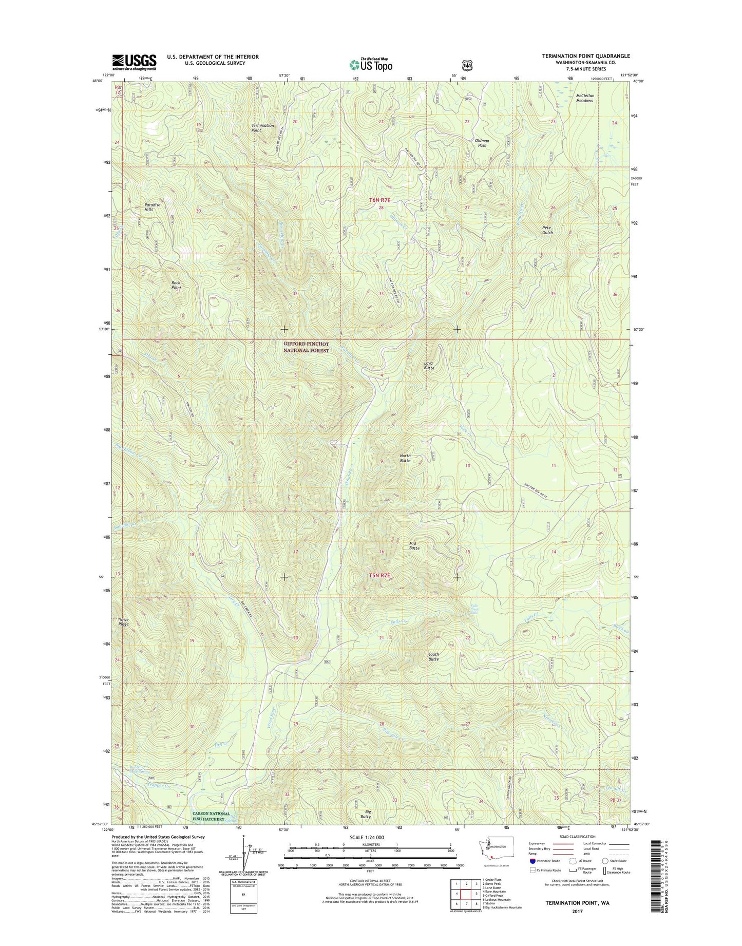
Termination Point Washington US Topo Map
Couldn't load pickup availability
Also explore the Termination Point Forest Service Topo of this same quad for updated USFS data
2023 topographic map quadrangle Termination Point in the state of Washington. Scale: 1:24000. Based on the newly updated USGS 7.5' US Topo map series, this map is in the following counties: Skamania. The map contains contour data, water features, and other items you are used to seeing on USGS maps, but also has updated roads and other features. This is the next generation of topographic maps. Printed on high-quality waterproof paper with UV fade-resistant inks.
Quads adjacent to this one:
West: Bare Mountain
Northwest: Cedar Flats
North: Burnt Peak
Northeast: Lone Butte
East: Gifford Peak
Southeast: Big Huckleberry Mountain
South: Stabler
Southwest: Lookout Mountain
This map covers the same area as the classic USGS quad with code o45121h8.
Contains the following named places: Big Butte, Big Hollow Creek, Black Creek, Bourbon Creek, Bubbling Mike Spring, Dry Creek, Falls Creek, Falls Creek Falls, Falls Creek Trail, Government Mineral Springs, Government Spring Guard Station, Home Guard Station, Howe Ridge, Juice Creek, Lava Butte, Lava Butte Trail, McClellan Meadows, Middle Butte, Ninemile Creek, North Butte, Oldman Creek, Oldman Pass, Paradise Creek, Paradise Creek Campground, Paradise Trail, Pete Gulch, Proverbial Creek, Ridge Trail, Rock Point, South Butte, Termination Point, Trapper Creek, Tyee Springs, Upper Wind River Winter Sports Area, Wind River Mine