MyTopo
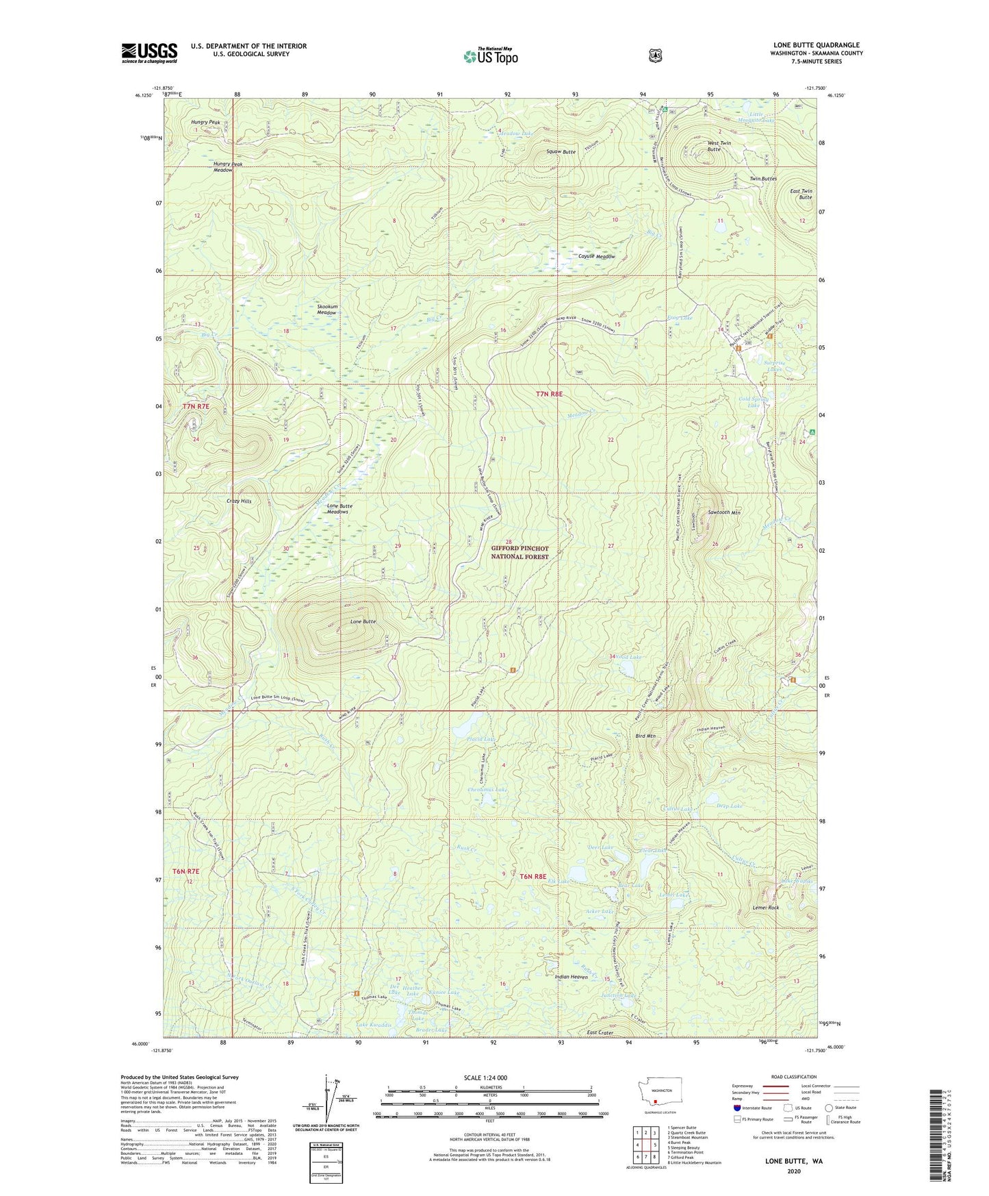
Lone Butte Washington US Topo Map
Couldn't load pickup availability
Also explore the Lone Butte Forest Service Topo of this same quad for updated USFS data
2023 topographic map quadrangle Lone Butte in the state of Washington. Scale: 1:24000. Based on the newly updated USGS 7.5' US Topo map series, this map is in the following counties: Skamania. The map contains contour data, water features, and other items you are used to seeing on USGS maps, but also has updated roads and other features. This is the next generation of topographic maps. Printed on high-quality waterproof paper with UV fade-resistant inks.
Quads adjacent to this one:
West: Burnt Peak
Northwest: Spencer Butte
North: Quartz Creek Butte
Northeast: Steamboat Mountain
East: Sleeping Beauty
Southeast: Little Huckleberry Mountain
South: Gifford Peak
Southwest: Termination Point
This map covers the same area as the classic USGS quad with code o46121a7.
Contains the following named places: Acker Lake, Bear Lake, Bird Mountain, Brader Lake, Cayuse Meadow, Chenamus Lake, Clear Lake, Cold Spring Campground, Cold Spring Lake, Cultus Creek Campground, Cultus Creek Station, Cultus Lake, Dee Lake, Deep Lake, Deer Lake, East Twin Butte, Elk Lake, Eunice Lake, Frog Lake, Heather Lake, Hungry Peak, Hungry Peak Lookout, Hungry Peak Meadow, Indian Heaven Lakes, Indian Heaven Wilderness, Indian View Point, Junction Lake, Lake Kwaddis, Lemei Lake, Lemei Rock, Little Mosquito Lake, Lone Butte, Lone Butte Meadows, Lone Butte Quarry, Meadow Creek, Meadow Creek Indian Camp, Meadow Lake, Mosquito Lake Station, Mount Saint Helens Viewpoint, Placid Lake, Saddle Campground, Sawtooth Mountain, Skookum Meadow, South Campground, Squaw Butte, Surprise Lake Indian Camp, Surprise Lakes, Thomas Lake, Tillicum Campground, Twin Buttes, West Twin Butte, West Twin Butte Lookout, Wood Lake