MyTopo
Tiptop Washington US Topo Map
Couldn't load pickup availability
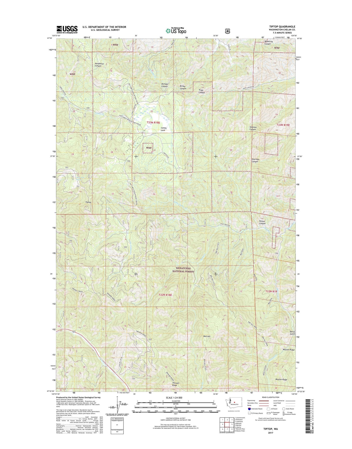
2020 topographic map quadrangle Tiptop in the state of Washington. Scale: 1:24000. Based on the newly updated USGS 7.5' US Topo map series, this map is in the following counties: Chelan. The map contains contour data, water features, and other items you are used to seeing on USGS maps, but also has updated roads and other features. This is the next generation of topographic maps. Printed on high-quality waterproof paper with UV fade-resistant inks.
Quads adjacent to this one:
West: Blewett
Northwest: Leavenworth
North: Peshastin
Northeast: Cashmere
East: Monitor
Southeast: Mission Peak
South: Blewett Pass
Southwest: Liberty
Contains the following named places: Bonanza Campground, Camas Land, Cashmere Division, Deer Park Spring, Devils Gulch, East Fork Mission Creek, Little Camas Creek, Poison Canyon, Red Hill, Red Hill Trail, Ruby Creek Trail, Sand Creek, State of Washington, Tiptop, Tiptop Mount Lillian Trail, West Sand Creek Trail