MyTopo
Tulalip Washington US Topo Map
Couldn't load pickup availability
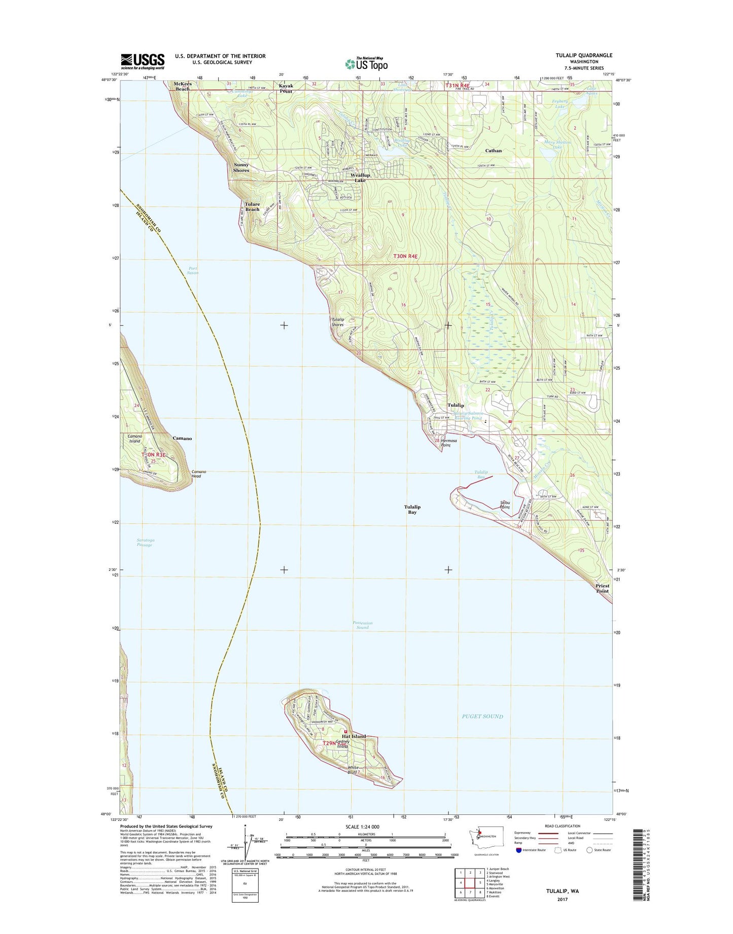
2023 topographic map quadrangle Tulalip in the state of Washington. Scale: 1:24000. Based on the newly updated USGS 7.5' US Topo map series, this map is in the following counties: Snohomish, Island. The map contains contour data, water features, and other items you are used to seeing on USGS maps, but also has updated roads and other features. This is the next generation of topographic maps. Printed on high-quality waterproof paper with UV fade-resistant inks.
Quads adjacent to this one:
West: Langley
Northwest: Juniper Beach
North: Stanwood
Northeast: Arlington West
East: Marysville
Southeast: Everett
South: Mukilteo
Southwest: Maxwelton
This map covers the same area as the classic USGS quad with code o48122a3.
Contains the following named places: Camano Head, Cathan, Cathan Census Designated Place, Cummings Lake, Firetrail, Fryberg Lake, Gedney Island, Hat Island Census Designated Place, Hat Island Yacht Club, Hermosa Point, Lake Agnes, Mary Shelton Lake, Mission Beach, Mission Beach Census Designated Place, Mission Beach Wastewater Treatment Plant, Mission Creek, Mission Highlands, Port Susan, Port Susan Census Designated Place, Priest Point, Skiou Point, Snohomish County Fire District 15 Station, Snohomish County Fire District 27, Spee-Bi-Dah, Spee-Bi-Dah Census Designated Place, Sunny Shores, Tulalip, Tulalip Bay, Tulalip Bay Census Designated Place, Tulalip Creek, Tulalip Elementary School, Tulalip Marina, Tulalip Reservation, Tulalip Reservation Division, Tulalip Salmon Rearing Pond, Tulalip Shores, Tulalip Tribe Rearing Pond Dam, Tulalip Tribes of Washington Salmon Hatchery, Tulare Beach, Waterworks, Waterworks Census Designated Place, Weallup Lake, Weallup Lake Census Designated Place, White Bluff