MyTopo
Tunnel Island Washington US Topo Map
Couldn't load pickup availability
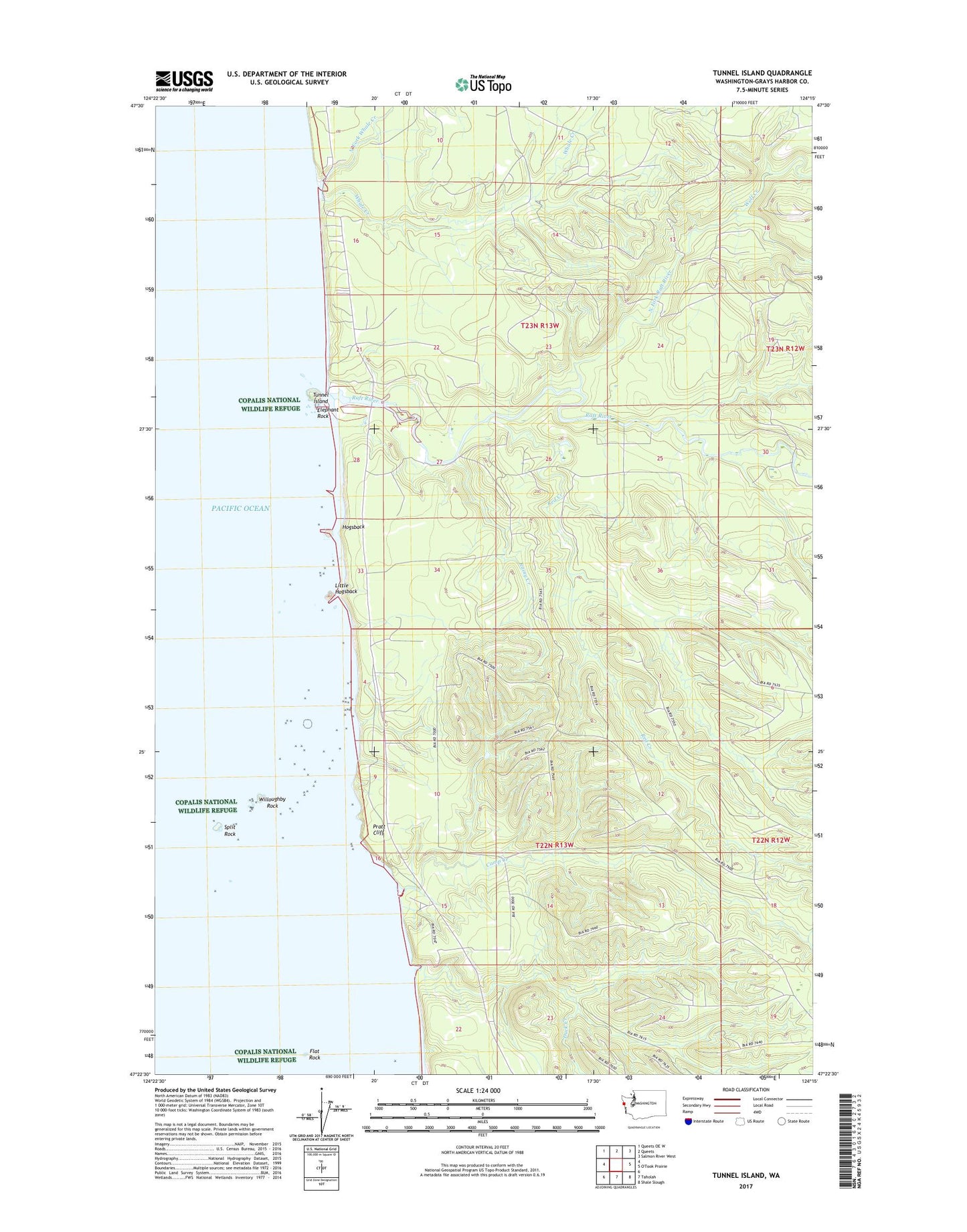
2023 topographic map quadrangle Tunnel Island in the state of Washington. Scale: 1:24000. Based on the newly updated USGS 7.5' US Topo map series, this map is in the following counties: Grays Harbor. The map contains contour data, water features, and other items you are used to seeing on USGS maps, but also has updated roads and other features. This is the next generation of topographic maps. Printed on high-quality waterproof paper with UV fade-resistant inks.
Quads adjacent to this one:
Northwest: Queets OE W
North: Queets
Northeast: Salmon River West
Southeast: Shale Slough
South: Taholah
This map covers the same area as the classic USGS quad with code o47124d3.
Contains the following named places: Camp Creek, Copalis National Wildlife Refuge, Duck Creek, Elephant Rock, Flat Rock, Hogsback, Little Hogsback, North Fork Raft River, North Fork Whale Creek, Pratt Cliff, Raft River, Rainy Creek, Red Creek, Split Rock, Tunnel Island, Whale Creek, Willoughby Rock, Wolf Creek