MyTopo
Taholah Washington US Topo Map
Couldn't load pickup availability
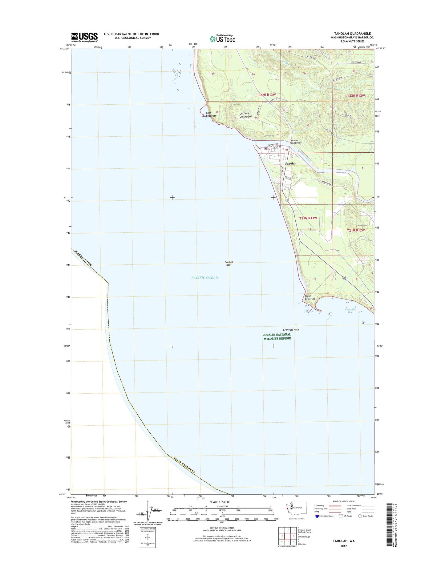
2023 topographic map quadrangle Taholah in the state of Washington. Scale: 1:24000. Based on the newly updated USGS 7.5' US Topo map series, this map is in the following counties: Grays Harbor. The map contains contour data, water features, and other items you are used to seeing on USGS maps, but also has updated roads and other features. This is the next generation of topographic maps. Printed on high-quality waterproof paper with UV fade-resistant inks.
Quads adjacent to this one:
North: Tunnel Island
East: Shale Slough
Southeast: Moclips
This map covers the same area as the classic USGS quad with code o47124c3.
Contains the following named places: Cape Elizabeth, Copalis Rock National Wildlife Refuge, Garfield Gas Mound, Grenville Arch, Grenville Bay, Point Grenville, Quinault Indian Nation Moclips River Estates Wastewater Treatment Plant, Quinault Indian Nation Taholah Village Wastewater Treatment Plant, Quinault Nation Ambulance, Quinault Nation Police Department, Quinault River, Quinault Road Bridge, Sonora Reef, Taholah, Taholah Census Designated Place, Taholah Fire Department, Taholah Post Office, Taholah School