MyTopo
Shale Slough Washington US Topo Map
Couldn't load pickup availability
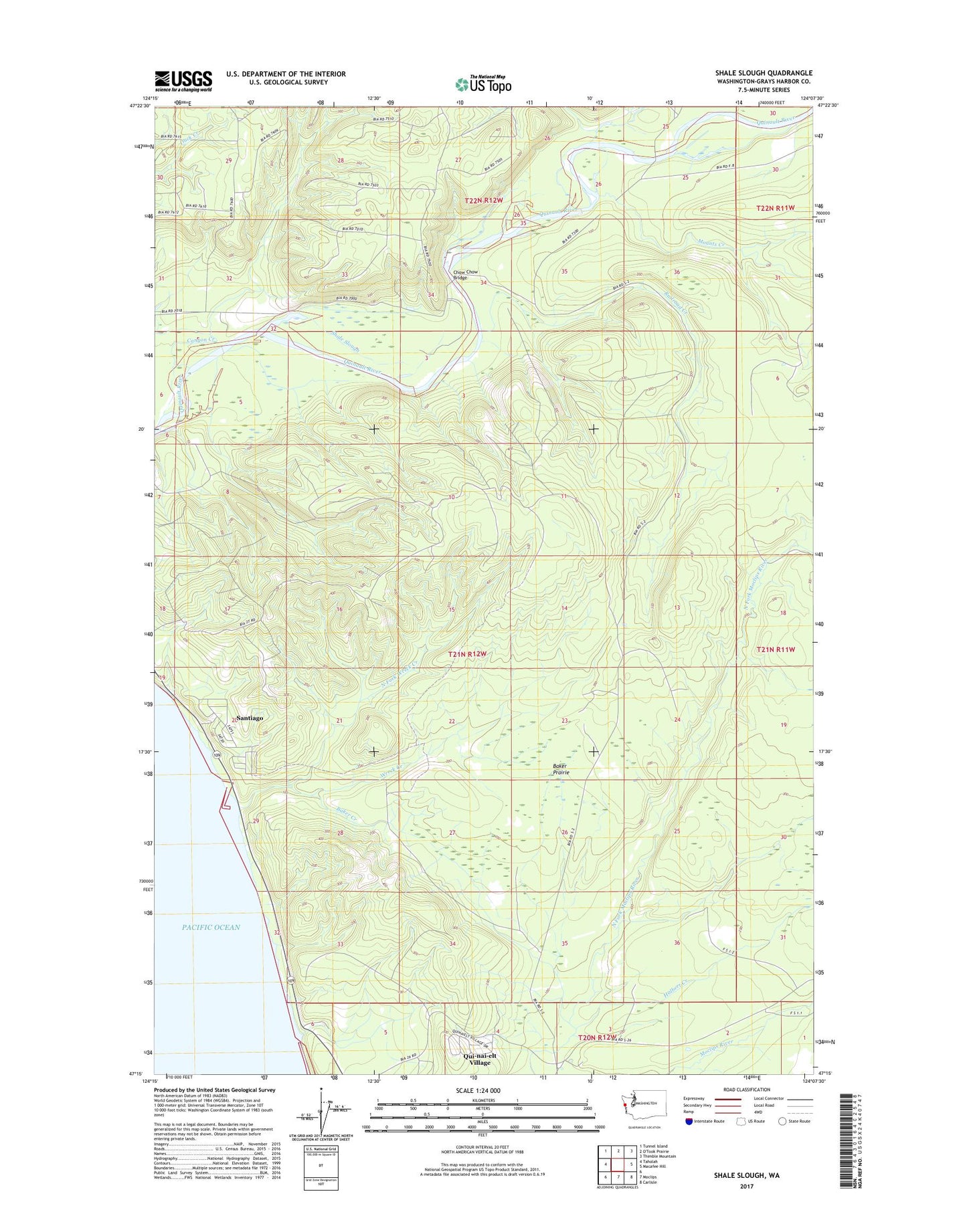
2023 topographic map quadrangle Shale Slough in the state of Washington. Scale: 1:24000. Based on the newly updated USGS 7.5' US Topo map series, this map is in the following counties: Grays Harbor. The map contains contour data, water features, and other items you are used to seeing on USGS maps, but also has updated roads and other features. This is the next generation of topographic maps. Printed on high-quality waterproof paper with UV fade-resistant inks.
Quads adjacent to this one:
West: Taholah
Northwest: Tunnel Island
Northeast: Thimble Mountain
East: Macafee Hill
Southeast: Carlisle
South: Moclips
This map covers the same area as the classic USGS quad with code o47124c2.
Contains the following named places: Baker Creek, Baker Prairie, California Slough, Canyon Creek, Chow Chow Bridge, Halbert Creek, Mounts Creek, No Name Creek, North Fork Wreck Creek, O'Took Creek, Qui-nai-elt Village Census Designated Place, Railroad Creek, Santiago Census Designated Place, Shale Slough, Wreck Creek, ZIP Code: 98587