MyTopo
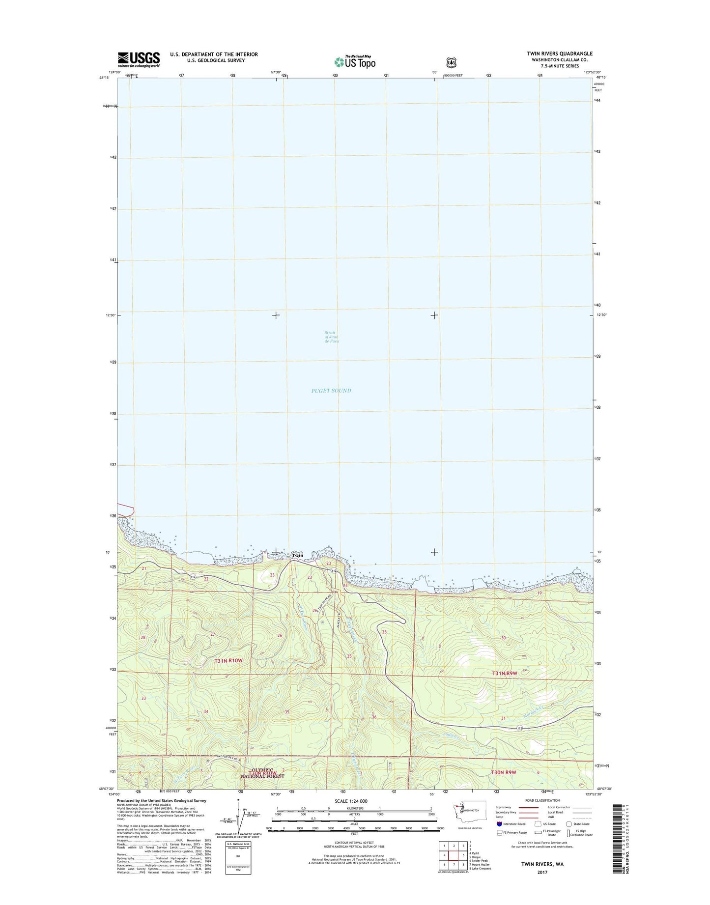
Twin Rivers Washington US Topo Map
Couldn't load pickup availability
Also explore the Twin Rivers Forest Service Topo of this same quad for updated USFS data
2023 topographic map quadrangle Twin Rivers in the state of Washington. Scale: 1:24000. Based on the newly updated USGS 7.5' US Topo map series, this map is in the following counties: Clallam. The map contains contour data, water features, and other items you are used to seeing on USGS maps, but also has updated roads and other features. This is the next generation of topographic maps. Printed on high-quality waterproof paper with UV fade-resistant inks.
Quads adjacent to this one:
West: Pysht
East: Disque
Southeast: Lake Crescent
South: Mount Muller
Southwest: Snider Peak
This map covers the same area as the classic USGS quad with code o48123b8.
Contains the following named places: East Twin River, Sadie Creek, Twin, West Twin River