MyTopo
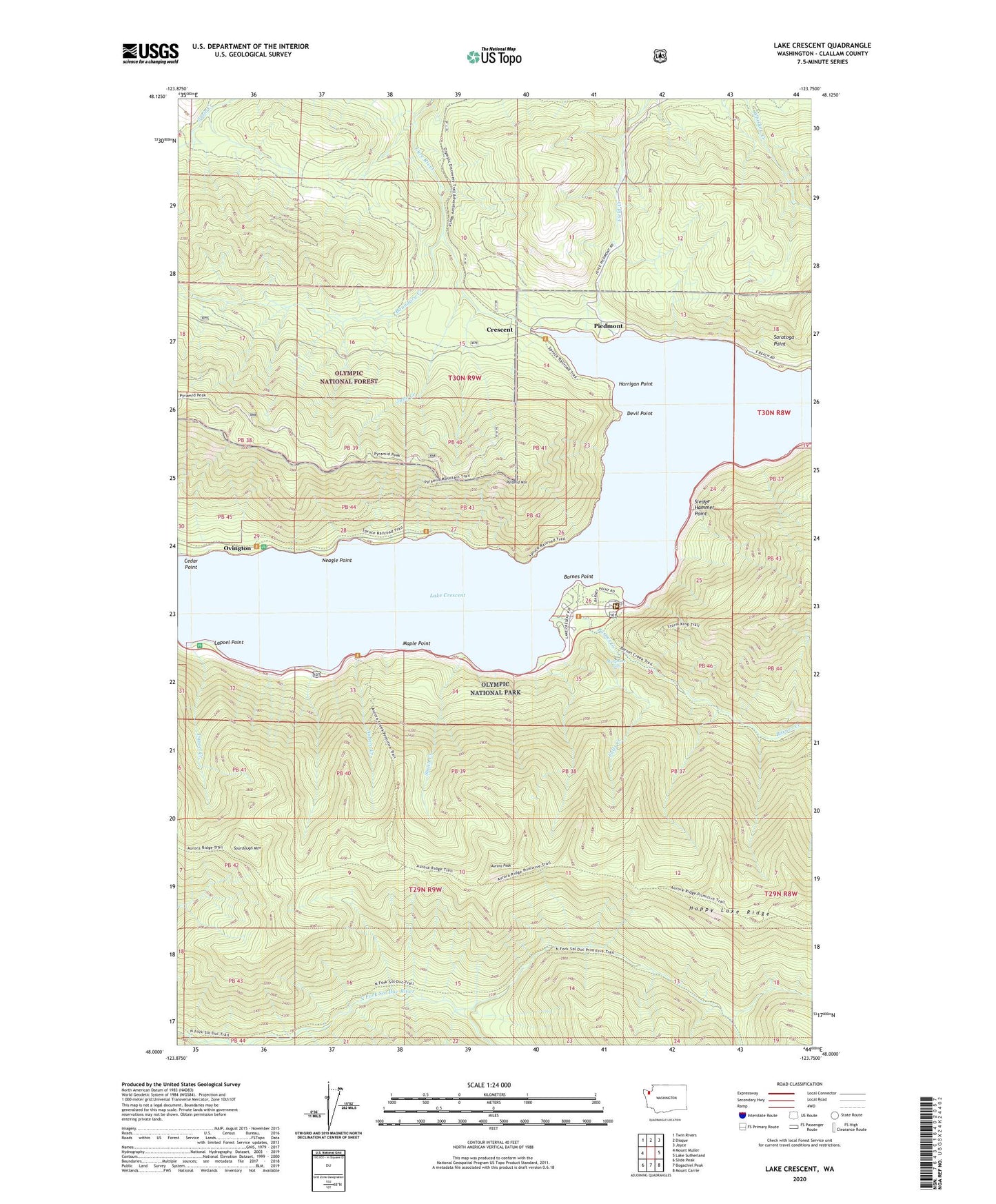
Lake Crescent Washington US Topo Map
Couldn't load pickup availability
Also explore the Lake Crescent Forest Service Topo of this same quad for updated USFS data
2023 topographic map quadrangle Lake Crescent in the state of Washington. Scale: 1:24000. Based on the newly updated USGS 7.5' US Topo map series, this map is in the following counties: Clallam. The map contains contour data, water features, and other items you are used to seeing on USGS maps, but also has updated roads and other features. This is the next generation of topographic maps. Printed on high-quality waterproof paper with UV fade-resistant inks.
Quads adjacent to this one:
West: Mount Muller
Northwest: Twin Rivers
North: Disque
Northeast: Joyce
East: Lake Sutherland
Southeast: Mount Carrie
South: Bogachiel Peak
Southwest: Slide Peak
This map covers the same area as the classic USGS quad with code o48123a7.
Contains the following named places: Aurora Creek, Aurora Peak, Barnes Creek, Barnes Point, Barnes Point Picnic Area, Boundary Creek, Cedar Point, Crescent, Crescent Division, Devil Point, Falls Creek, Harrigan Point, June Creek, La Poel Picnic Area, Lake Crescent, Lake Crescent Ranger Station, Lapoel Creek, Lapoel Point, Maple Point, Marymere Falls, Neagle Point, North Fork Soleduck River Trail, North Shore Picnic Area, Ovington, Piedmont, Pyramid Mountain, Pyramid Mountain Trail, Rosemary, Saratoga Point, Singers, Sledge Hammer Point, Smith Creek, Sourdough Mountain, ZIP Code: 98363