MyTopo
Uniontown Washington US Topo Map
Couldn't load pickup availability
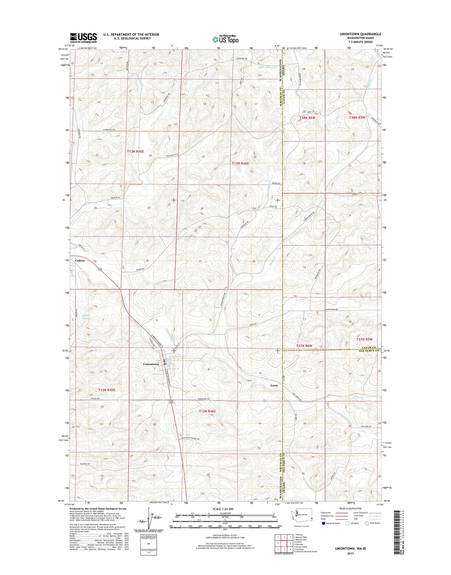
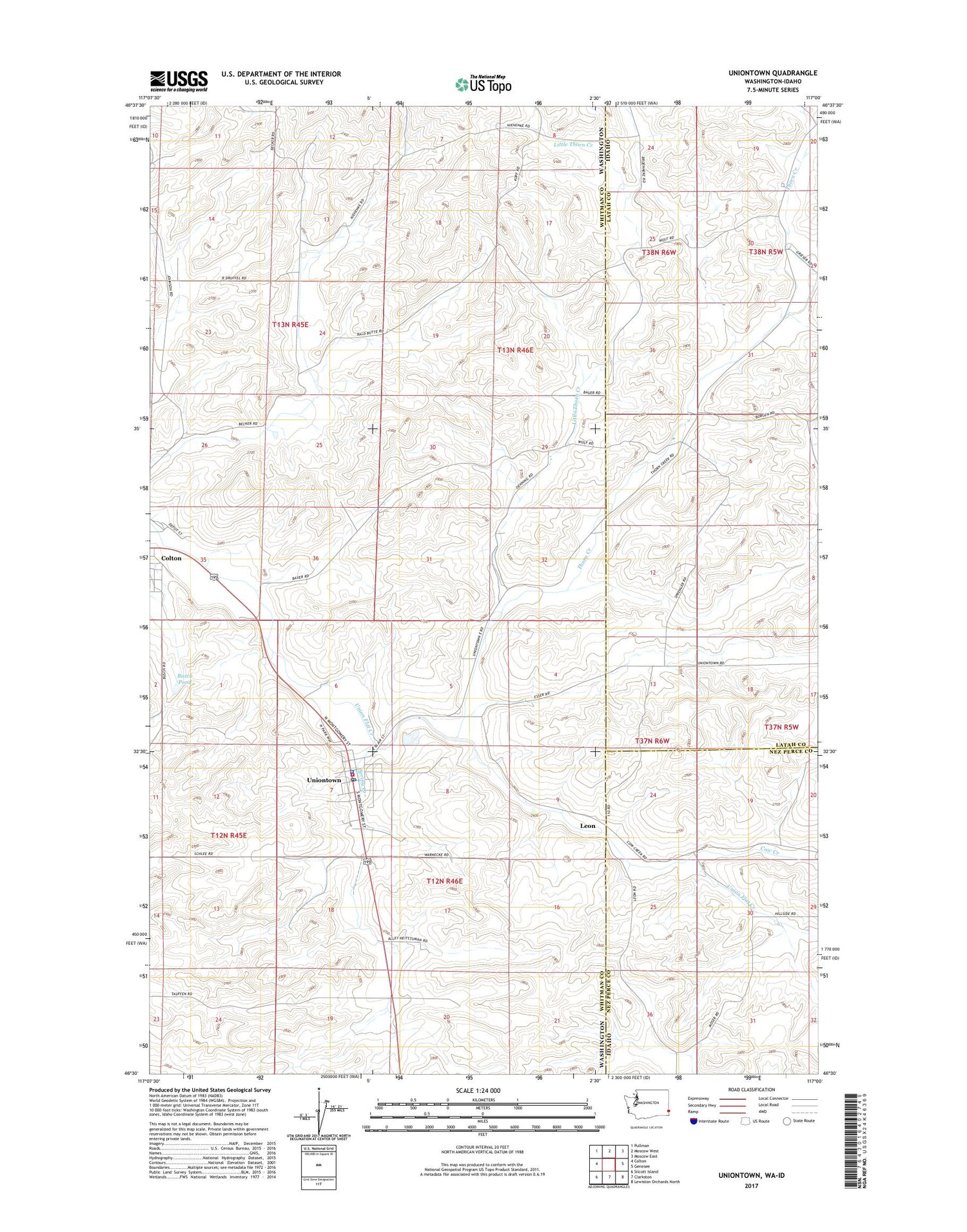
2020 topographic map quadrangle Uniontown in the states of Washington, Idaho. Scale: 1:24000. Based on the newly updated USGS 7.5' US Topo map series, this map is in the following counties: Whitman, Latah, Nez Perce. The map contains contour data, water features, and other items you are used to seeing on USGS maps, but also has updated roads and other features. This is the next generation of topographic maps. Printed on high-quality waterproof paper with UV fade-resistant inks.
Quads adjacent to this one:
West: Colton
Northwest: Pullman
North: Moscow West
Northeast: Moscow East
East: Genesee
Southeast: Lewiston Orchards North
South: Clarkston
Southwest: Silcott Island
Contains the following named places: Busch Pond, Busch Pond Dam, Cow Creek, Leon, Little Thorn Creek, Saint Bonaface School, Spring Creek, Thorn Creek, Thorn Creek Ranch, Town of Uniontown, Uniontown, Uniontown Police Department, Uniontown Post Office, Whitman Fire District 14 Station 2