MyTopo
Lewiston Orchards North Idaho US Topo Map
Couldn't load pickup availability
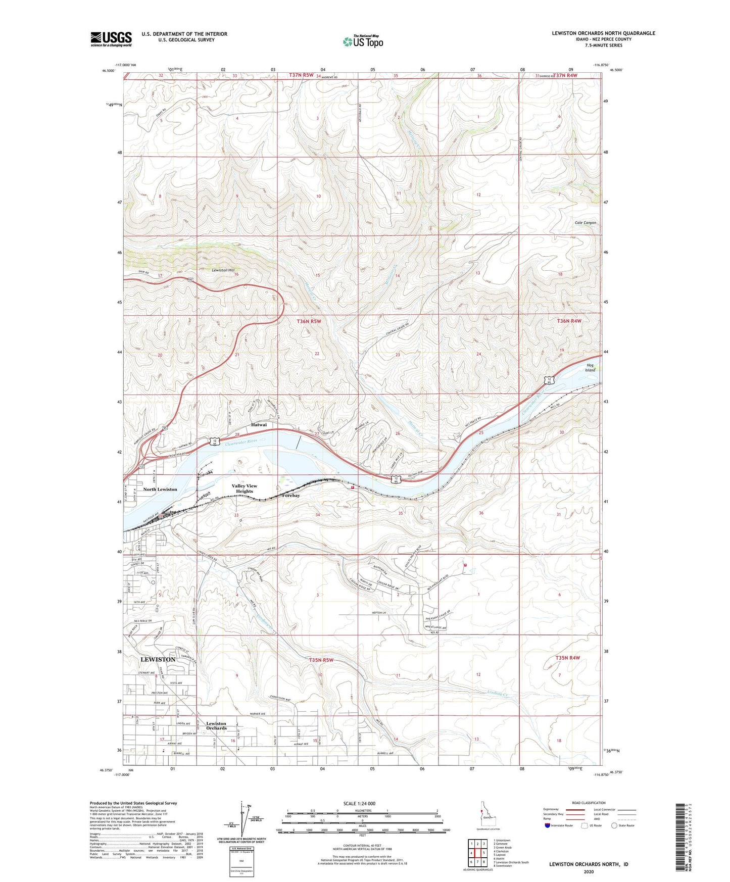
2024 topographic map quadrangle Lewiston Orchards North in the state of Idaho. Scale: 1:24000. Based on the newly updated USGS 7.5' US Topo map series, this map is in the following counties: Nez Perce. The map contains contour data, water features, and other items you are used to seeing on USGS maps, but also has updated roads and other features. This is the next generation of topographic maps. Printed on high-quality waterproof paper with UV fade-resistant inks.
Quads adjacent to this one:
West: Clarkston
Northwest: Uniontown
North: Genesee
Northeast: Green Knob
East: Lapwai
Southeast: Sweetwater
South: Lewiston Orchards South
Southwest: Asotin
This map covers the same area as the classic USGS quad with code o46116d8.
Contains the following named places: City of Lewiston, Forebay, Garfield School, Gurney, Hatwai, Hatwai Creek, Hidden Lake, Lewiston Hill, Lewiston Orchards, Lewiston Police Training Center, Lindsay Creek, Mark Means Park, McGhee Elementary School, McGuire Creek, Orchards Elementary School, Potlatch Corporation Fire and Rescue Department, Southgate Plaza, Valley View Heights, Wheatland Volunteer Fire Department