MyTopo
Silcott Island Washington US Topo Map
Couldn't load pickup availability
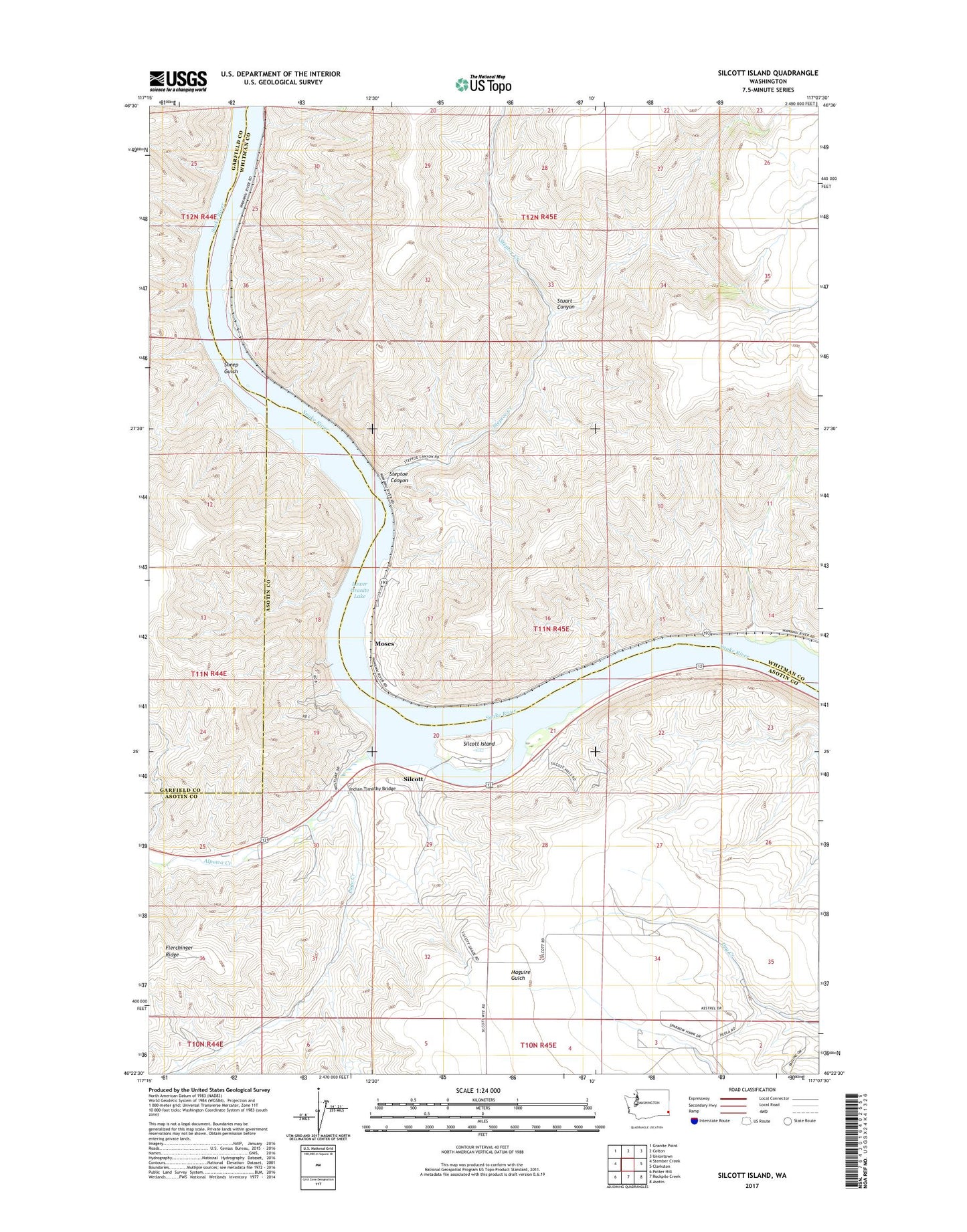
2023 topographic map quadrangle Silcott Island in the state of Washington. Scale: 1:24000. Based on the newly updated USGS 7.5' US Topo map series, this map is in the following counties: Whitman, Asotin, Garfield. The map contains contour data, water features, and other items you are used to seeing on USGS maps, but also has updated roads and other features. This is the next generation of topographic maps. Printed on high-quality waterproof paper with UV fade-resistant inks.
Quads adjacent to this one:
West: Stember Creek
Northwest: Granite Point
North: Colton
Northeast: Uniontown
East: Clarkston
Southeast: Asotin
South: Rockpile Creek
Southwest: Potter Hill
This map covers the same area as the classic USGS quad with code o46117d2.
Contains the following named places: Alpowa, Alpowa Creek, Chief Timothy State Park, Indian Timothy Bridge, Moses, Nisqually John Landing, Page Creek, Sheep Gulch, Silcott, Silcott Island, Steptoe Canyon, Steptoe Creek, Steptoe Lower Range, Stuart Canyon, ZIP Code: 99179