MyTopo
Clarkston Washington US Topo Map
Couldn't load pickup availability
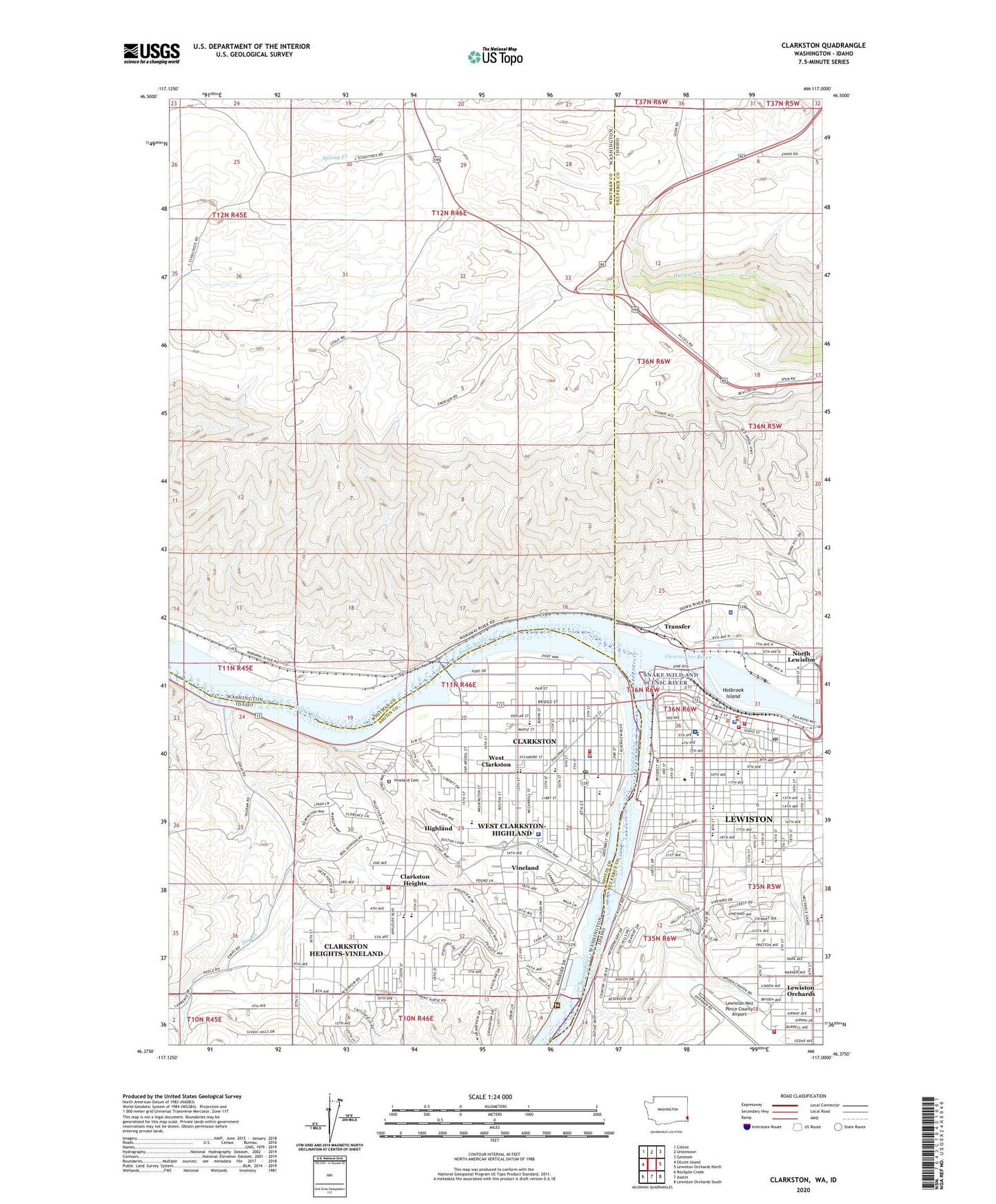
2023 topographic map quadrangle Clarkston in the states of Washington, Idaho. Scale: 1:24000. Based on the newly updated USGS 7.5' US Topo map series, this map is in the following counties: Asotin, Whitman, Nez Perce. The map contains contour data, water features, and other items you are used to seeing on USGS maps, but also has updated roads and other features. This is the next generation of topographic maps. Printed on high-quality waterproof paper with UV fade-resistant inks.
Quads adjacent to this one:
West: Silcott Island
Northwest: Colton
North: Uniontown
Northeast: Genesee
East: Lewiston Orchards North
Southeast: Lewiston Orchards South
South: Asotin
Southwest: Rockpile Creek
This map covers the same area as the classic USGS quad with code o46117d1.
Contains the following named places: Asotin County Fire Department Lewiston Medic 73, Asotin County Heliport, Asotin County Library, Beachview Park, Beacon Christian School, C F Adams High School, Charles Francis Adams High School, City of Clarkston, Clarkston, Clarkston Fire Department, Clarkston Golf and Country Club, Clarkston Heights, Clarkston Heights-Vineland Census Designated Place, Clarkston Police Department, Clarkston Post Office, Clarkston Shopping Center, Clearwater River, Clearwater River Memorial Bridge, Dry Creek, Educational Opportunity Center, Foster Park, Gateway Square, Grantham Elementary School, Highland, Highland Elementary School, Holbrook Island, Holy Family School, Jenifer Junior High School, KCLK-FM (Clarkston), Lewis - Clark State College, Lewiston, Lewiston Fire Department Station 1, Lewiston Fire Department Station 4, Lewiston Golf and Country Club, Lewiston Police Department, Lewiston Post Office, Lewiston Senior High School, Lewiston Shopping Center, Lincoln Middle School, McSorley Elementary School, Nez Perce County Fire Department, Nez Perce County Sheriff's Office, Normal Hill Cemetery, North Lewiston, Northwest Childrens Home Education Center, O and M Facilities Heliport, Parkway Elementary School, River Crest Hospital, Saint Joseph Regional Medical Center, Saint Stanislaus Tri - Parish School, Shiloh Schools, Snake River Seaplane Base, Stout Ranch, Sunset Center, Sunset Palisades Dam, Swallows Park, Transfer, Tri - State Memorial Hospital and Medical Campus, Vernon Park, Vineland, Vineland Cemetery, Vollmer Park, Webster Elementary School, West Clarkston, West Clarkston-Highland Census Designated Place, Westgate Shopping Center, Whitman Elementary School