MyTopo
Forest Center Washington US Topo Map
Couldn't load pickup availability
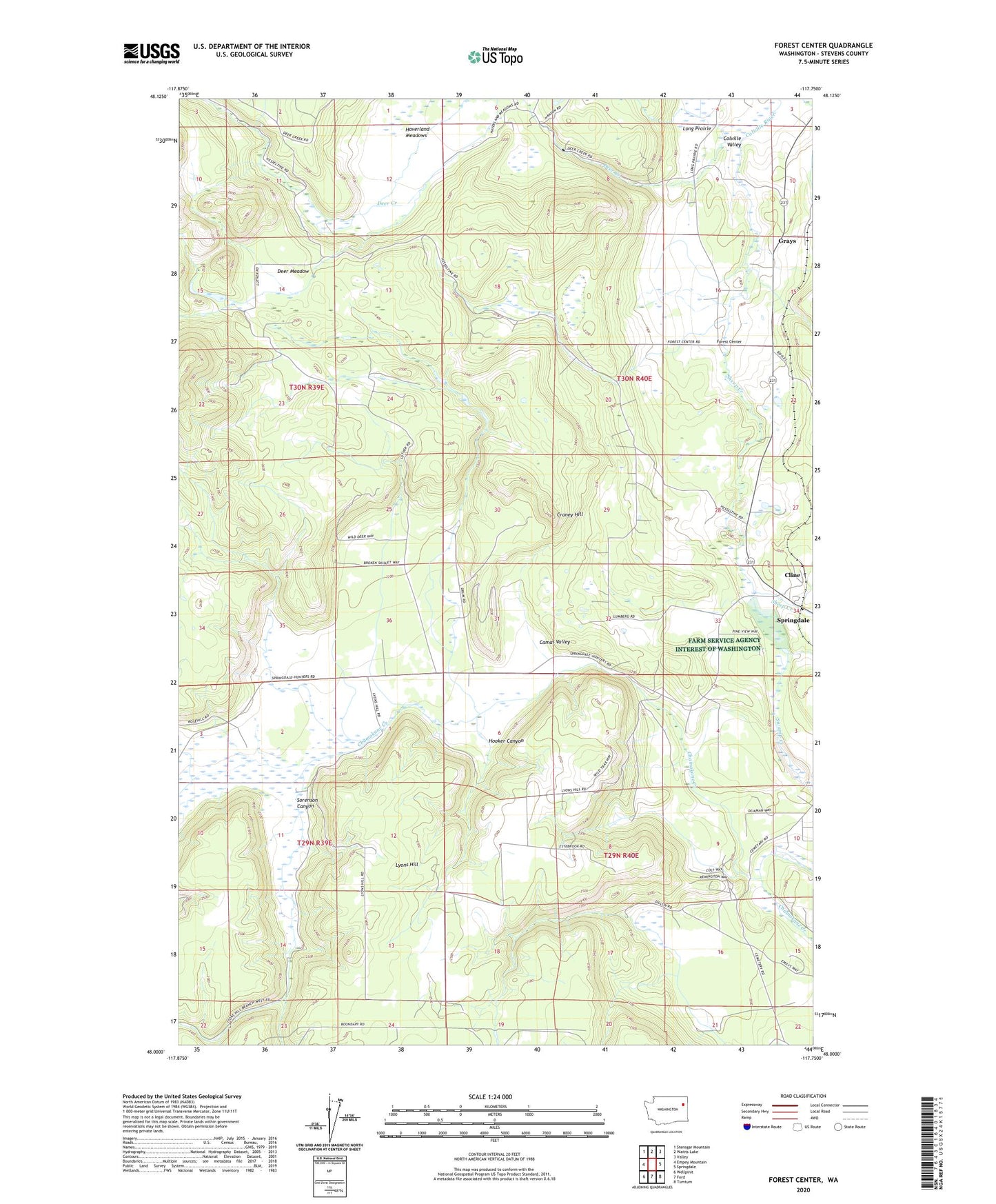
2023 topographic map quadrangle Forest Center in the state of Washington. Scale: 1:24000. Based on the newly updated USGS 7.5' US Topo map series, this map is in the following counties: Stevens. The map contains contour data, water features, and other items you are used to seeing on USGS maps, but also has updated roads and other features. This is the next generation of topographic maps. Printed on high-quality waterproof paper with UV fade-resistant inks.
Quads adjacent to this one:
West: Empey Mountain
Northwest: Stensgar Mountain
North: Waitts Lake
Northeast: Valley
East: Springdale
Southeast: Tumtum
South: Ford
Southwest: Wellpinit
This map covers the same area as the classic USGS quad with code o48117a7.
Contains the following named places: Camas, Camas Valley, Cline, Craney Hill, Deer Creek, Deer Meadow, Forest Center, Grays, Haverland Meadows, Hooker Canyon, Lyons Hill, Sheep Creek, Sorenson Canyon, Springdale Division, Swamp Creek, ZIP Code: 99173