MyTopo
Waitts Lake Washington US Topo Map
Couldn't load pickup availability
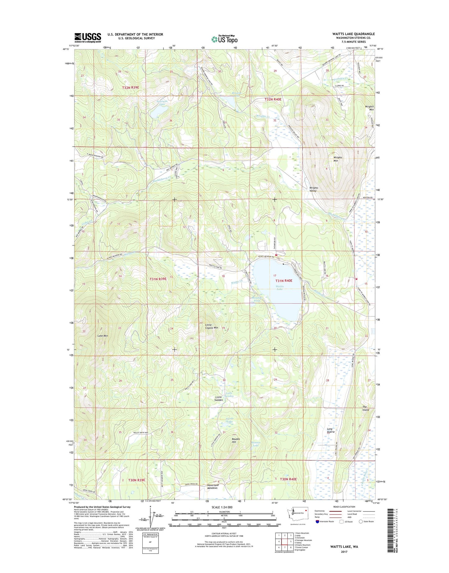
2020 topographic map quadrangle Waitts Lake in the state of Washington. Scale: 1:24000. Based on the newly updated USGS 7.5' US Topo map series, this map is in the following counties: Stevens. The map contains contour data, water features, and other items you are used to seeing on USGS maps, but also has updated roads and other features. This is the next generation of topographic maps. Printed on high-quality waterproof paper with UV fade-resistant inks.
Quads adjacent to this one:
West: Stensgar Mountain
Northwest: Dunn Mountain
North: Addy
Northeast: Chewelah
East: Valley
Southeast: Springdale
South: Forest Center
Southwest: Empey Mountain
Contains the following named places: B B Mine, Boudes Hill, Browns Lake, Browns Lake Dam, Cedar Creek, Colville Valley Mine, Finch Quarry, Fourmile Lake, Hansen Lake, Jim McGraff Quarry, Lane Mountain, Little Coyote Mountain, Little Sweden, Long Prairie, Meadow Pond, Moss-Allen Quarry, Stevens County Fire District 4 Command Vehicle, Stevens County Fire District 4 Station 42 - Waitts Lake, Swede Lake, The Island, Waits, Waitts Lake, Waitts Lake - Valley Sewage Treatment Plant, Waitts Lake Dam, Woodbury Quarry, Wrights Creek, Wrights Mountain, Wrights Valley, ZIP Code: 99181