MyTopo
Stensgar Mountain Washington US Topo Map
Couldn't load pickup availability
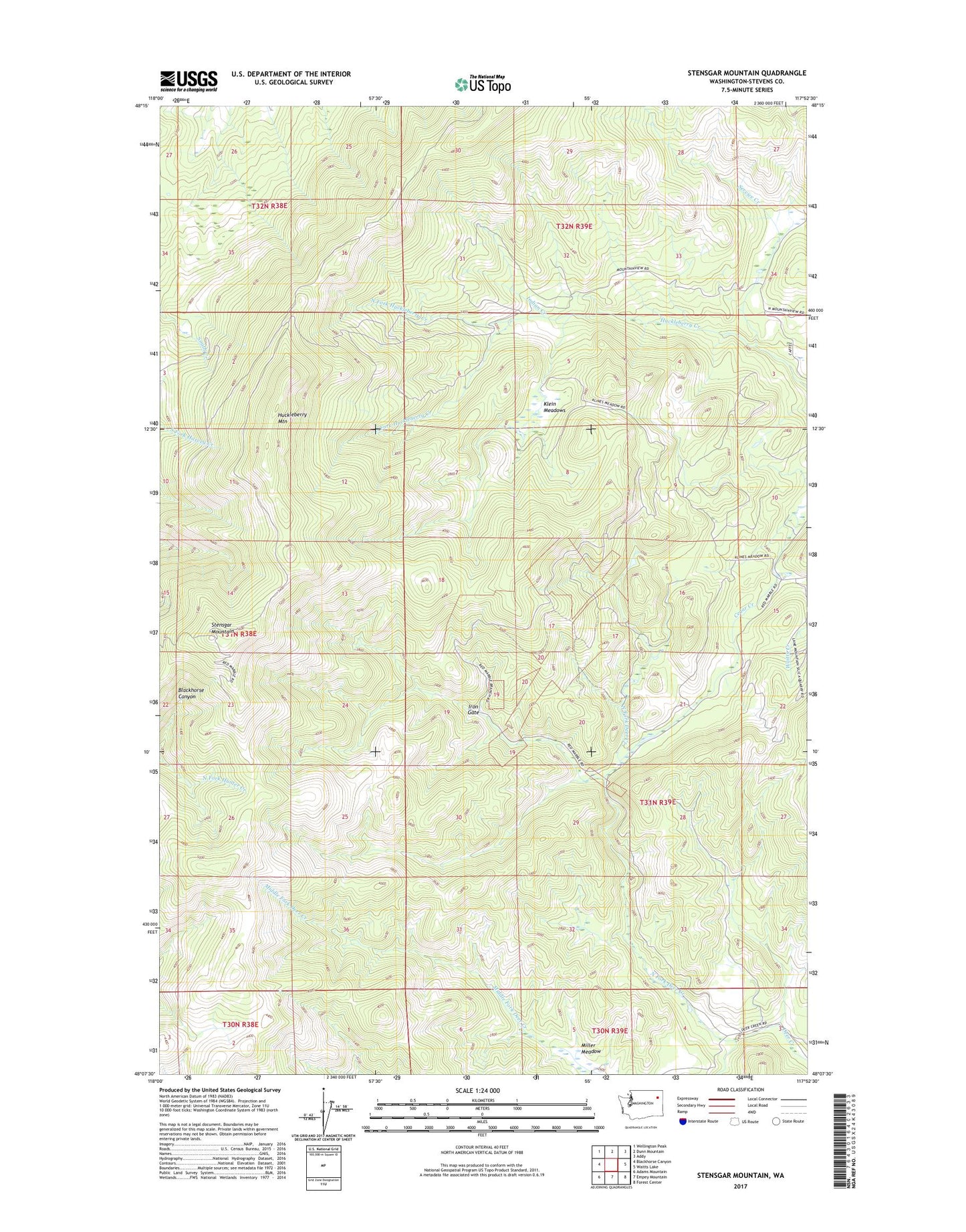
2023 topographic map quadrangle Stensgar Mountain in the state of Washington. Scale: 1:24000. Based on the newly updated USGS 7.5' US Topo map series, this map is in the following counties: Stevens. The map contains contour data, water features, and other items you are used to seeing on USGS maps, but also has updated roads and other features. This is the next generation of topographic maps. Printed on high-quality waterproof paper with UV fade-resistant inks.
Quads adjacent to this one:
West: Blackhorse Canyon
Northwest: Wellington Peak
North: Dunn Mountain
Northeast: Addy
East: Waitts Lake
Southeast: Forest Center
South: Empey Mountain
Southwest: Adams Mountain
This map covers the same area as the classic USGS quad with code o48117b8.
Contains the following named places: Admiral Mine, Carrs Corner, Double Eagle Quarries, Edna Mine, Huckleberry Mountain, Indian Creek, Iron Gate, Keystone Mine, Klein Meadows, Miller Meadow, North Fork Deer Creek, North Fork Huckleberry Creek, Service Creek, South Fork Huckleberry Creek, Stensgar Mountain, Wabash Detroit Mine, Wells Fargo Mine