MyTopo
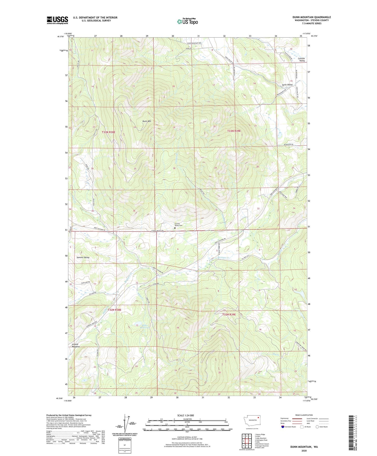
Dunn Mountain Washington US Topo Map
Couldn't load pickup availability
2023 topographic map quadrangle Dunn Mountain in the state of Washington. Scale: 1:24000. Based on the newly updated USGS 7.5' US Topo map series, this map is in the following counties: Stevens. The map contains contour data, water features, and other items you are used to seeing on USGS maps, but also has updated roads and other features. This is the next generation of topographic maps. Printed on high-quality waterproof paper with UV fade-resistant inks.
Quads adjacent to this one:
West: Wellington Peak
Northwest: Kentry Ridge
North: Arden
Northeast: Addy Mountain
East: Addy
Southeast: Waitts Lake
South: Stensgar Mountain
Southwest: Blackhorse Canyon
This map covers the same area as the classic USGS quad with code o48117c8.
Contains the following named places: Cassner Creek, Dunn, Dunn Creek, Dunn Mountain, Klein Creek, Miller Reservoir, Miller Reservoir Dam, Schmidt, Smith Creek, Summit Valley Cemetery, Summit Valley Community Church, Summit Valley School, Sunnyside School, Swiss Valley, Tango Ranch Airport, West Side School, Westside School, ZIP Code: 99101