
MyTopo
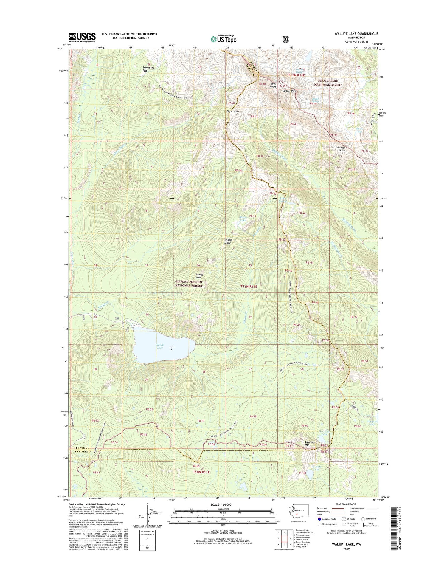
Walupt Lake Washington US Topo Map
Couldn't load pickup availability
2020 topographic map quadrangle Walupt Lake in the state of Washington. Scale: 1:24000. Based on the newly updated USGS 7.5' US Topo map series, this map is in the following counties: Lewis, Yakima. The map contains contour data, water features, and other items you are used to seeing on USGS maps, but also has updated roads and other features. This is the next generation of topographic maps. Printed on high-quality waterproof paper with UV fade-resistant inks.
Quads adjacent to this one:
West: Hamilton Buttes
Northwest: Packwood Lake
North: Old Snowy Mountain
Northeast: Pinegrass Ridge
East: Jennies Butte
Southeast: Windy Point
South: Glaciate Butte
Southwest: Green Mountain
Contains the following named places: Alpine Camp, Bypass Camp, Cispus Pass, Coleman Weedpatch, Conrad Glacier, Gertrude Lake, Gilbert Peak, Goat Rocks, Klickton Divide, Lake Corral, Lakeview Mountain, LeConte Lake, Meade Glacier, Nannie Peak, Nannie Peak Lookout, Nannie Ridge, Sheep Lake, Short Trail Camp, Snowgrass Flat, Walupt Creek, Walupt Lake, Walupt Lake Campground, Walupt Lake Guard Station, Walupt Lake Horse Camp, Warm Lake


