MyTopo
Windy Point Washington US Topo Map
Couldn't load pickup availability
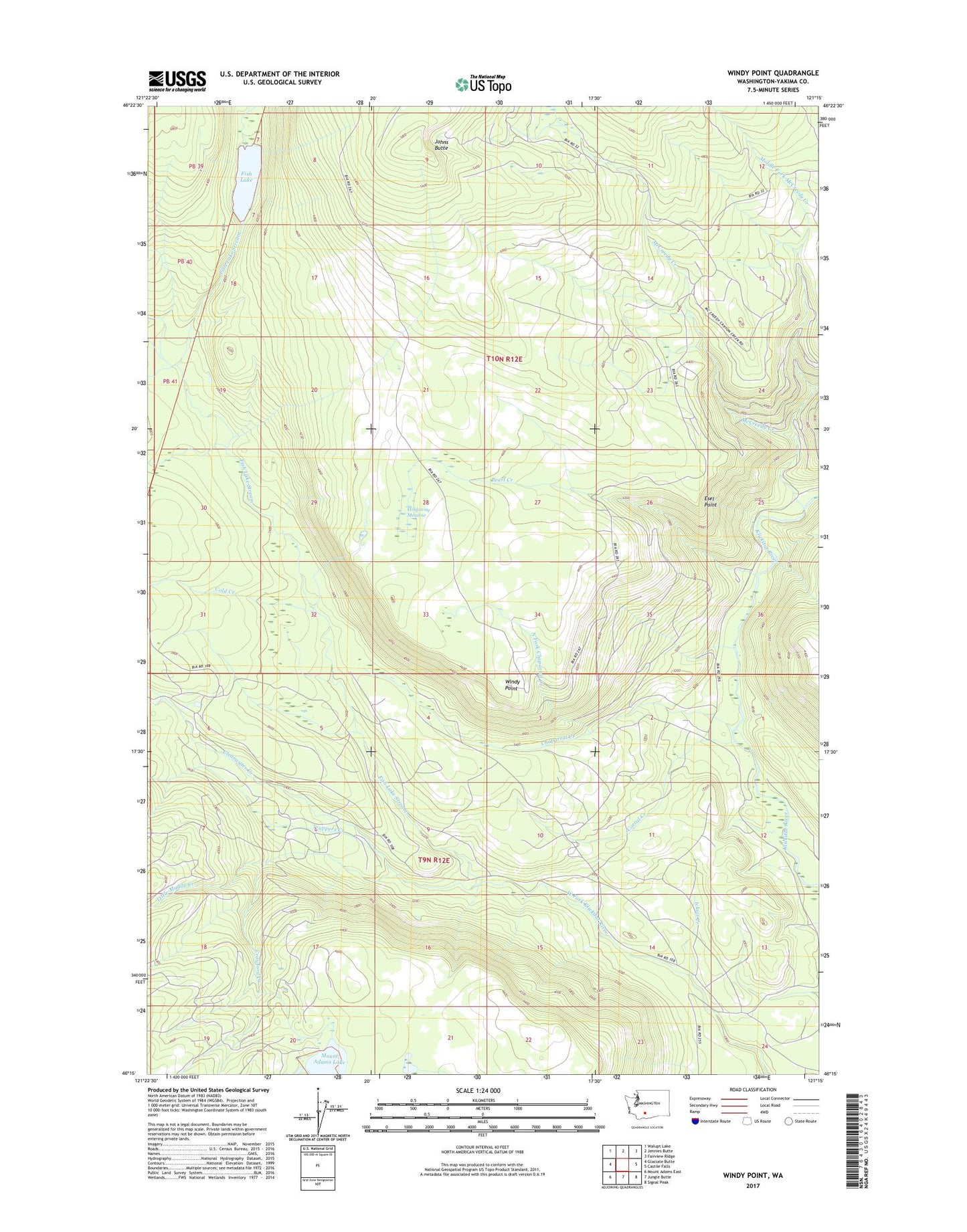
2023 topographic map quadrangle Windy Point in the state of Washington. Scale: 1:24000. Based on the newly updated USGS 7.5' US Topo map series, this map is in the following counties: Yakima. The map contains contour data, water features, and other items you are used to seeing on USGS maps, but also has updated roads and other features. This is the next generation of topographic maps. Printed on high-quality waterproof paper with UV fade-resistant inks.
Quads adjacent to this one:
West: Glaciate Butte
Northwest: Walupt Lake
North: Jennies Butte
Northeast: Fairview Ridge
East: Castile Falls
Southeast: Signal Peak
South: Jungle Butte
Southwest: Mount Adams East
This map covers the same area as the classic USGS quad with code o46121c3.
Contains the following named places: Camp Chaparral, Chaparral Creek, Clearwater Creek, Cold Creek, Corral Creek, Crawford Creek, East Fork McCreedy Creek, Esel Point, Fish Lake, Fish Lake Stream, Holdaway Meadow, Howard Lake Stream, Icksix Creek, Johns Butte, Little Muddy Creek, McCreedy Creek, Middle Fork McCreedy Creek, Mount Adams Lake, North Fork Chaparral Creek, Pearl Creek, Trappers Creek, Windy Point