MyTopo
White Pass Washington US Topo Map
Couldn't load pickup availability
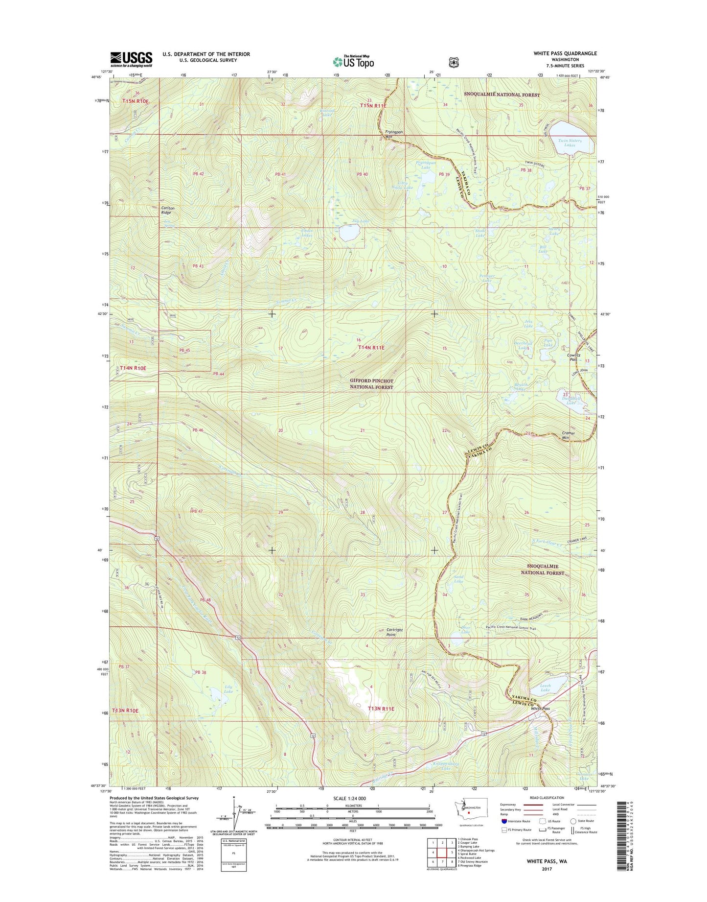
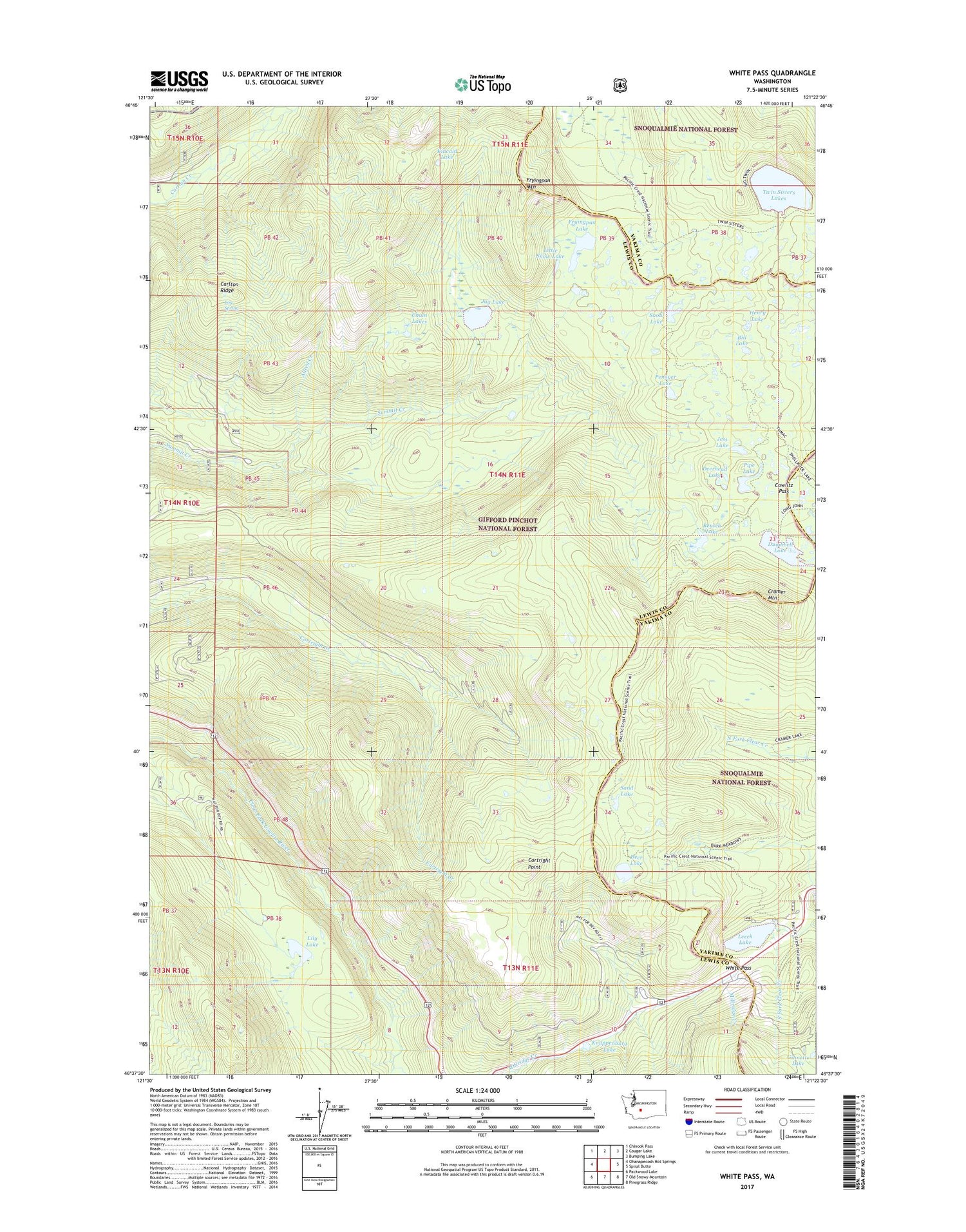
2020 topographic map quadrangle White Pass in the state of Washington. Scale: 1:24000. Based on the newly updated USGS 7.5' US Topo map series, this map is in the following counties: Lewis, Yakima. The map contains contour data, water features, and other items you are used to seeing on USGS maps, but also has updated roads and other features. This is the next generation of topographic maps. Printed on high-quality waterproof paper with UV fade-resistant inks.
Quads adjacent to this one:
West: Ohanapecosh Hot Springs
Northwest: Chinook Pass
North: Cougar Lake
Northeast: Bumping Lake
East: Spiral Butte
Southeast: Pinegrass Ridge
South: Old Snowy Mountain
Southwest: Packwood Lake
Contains the following named places: Allred Creek, Benchmark Lake, Beusch Lake, Bill Lake, Carlton Ridge, Chain Lakes, Clear Fork Trail, Cortright Creek Trail, Cortright Point, Cowlitz Pass, Cowlitz Trail, Cowlitz Trailhead, Cramer Mountain, Dark Meadows Trail, Deer Lake, Deerhead Lake, Dumbbell Lake, Fryingpan Lake, Fryingpan Mountain, Ginnette Lake, Henry Lake, Jess Lake, Jug Lake, Jug Lake Trail, Kincaid Lake, Kincaid Trail, Knuppenburg Lake, Knuppenburg Lake Campground, Lake Trail, Leech Lake, Lily Lake, Little Snow Lake, Log Spring, Millridge Creek, Penoyer Lake, Pipe Lake, Pony Creek, Sand Lake, Sand Lake Shelter, Sand Lake Trail, Skeelter Shelter, Skeeter Shelter, Snow Lake, Soda Springs Campground, Twin Sisters Lakes, White Pass, White Pass Campground, White Pass Ski Area, White Pass X Country Ski Area