MyTopo
Mount Adams East Washington US Topo Map
Couldn't load pickup availability
Also explore the Mount Adams East Forest Service Topo of this same quad for updated USFS data
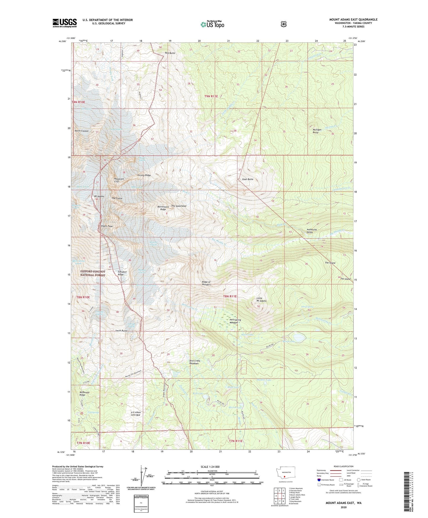
2023 topographic map quadrangle Mount Adams East in the state of Washington. Scale: 1:24000. Based on the newly updated USGS 7.5' US Topo map series, this map is in the following counties: Yakima. The map contains contour data, water features, and other items you are used to seeing on USGS maps, but also has updated roads and other features. This is the next generation of topographic maps. Printed on high-quality waterproof paper with UV fade-resistant inks.
Quads adjacent to this one:
West: Mount Adams West
Northwest: Green Mountain
North: Glaciate Butte
Northeast: Windy Point
East: Jungle Butte
Southeast: Glenwood
South: King Mountain
Southwest: Trout Lake
This map covers the same area as the classic USGS quad with code o46121b4.
Contains the following named places: Avalanche Valley, Battlement Ridge, Bench Lake, Bird Creek Meadows, Bird Creek Meadows Picnic Area, Bird Lake, Bluff Lake, Cold Springs, Cold Springs Campground, Crescent Glacier, Crooked Creek, Crooked Creek Falls, Devils Gardens, Goat Butte, Gotchen Glacier, Heart Lake, Hellroaring Meadow, Island Spring, Klickitat Glacier, Lava Glacier, Little Mount Adams, Lyman Glacier, Mazama Glacier, McDonald Ridge, Mirror Lake, Mount Adams, Mulligan Butte, North Cleaver, Pikers Peak, Red Butte, Ridge of Wonders, Roosevelt Cliff, Rusk Creek, Rusk Glacier, Shadow Lake, South Butte, Southwest Yakima Division, Suksdorf Ridge, The Castle, The Spearhead, Timberline Campground, Victory Ridge, Wilson Glacier